Husevågøy
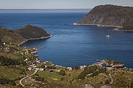 View from Mt. Blåfjellet towards the island of Vågsøy | |
 Husevågøy Location in Sogn og Fjordane county | |
| Geography | |
|---|---|
| Location | Sogn og Fjordane, Norway |
| Coordinates | 61°54′35″N 5°02′48″E / 61.9096°N 5.0468°ECoordinates: 61°54′35″N 5°02′48″E / 61.9096°N 5.0468°E |
| Area | 9.2 km2 (3.6 sq mi) |
| Length | 6.4 km (3.98 mi) |
| Width | 2.6 km (1.62 mi) |
| Highest elevation | 330 m (1,080 ft) |
| Highest point | Krabbestigheida |
| Administration | |
| County | Sogn og Fjordane |
| Municipality | Vågsøy Municipality |
Husevågøy is an island in Vågsøy Municipality in Sogn og Fjordane county, Norway. The 9.1-square-kilometre (3.5 sq mi) island is mountainous with few trees. The island lies in the mouth of the Nordfjorden, between the islands of Vågsøy and Bremangerlandet. In 2001, there were about 30 residents on the island. There is a car ferry that runs from the town of Måløy on Vågsøy island (to the north) to Husevågøy and then on to Oldeide on Bremangerlandet (to the south).[1]
Historically, the island was part of the old municipality of Davik. In 1964, Husevågøy and several small surrounding islands were transferred to Vågsøy Municipality.
Photo gallery
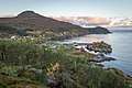
- View of the small village of Husevåg
 Husevåg
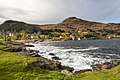 Husevåg
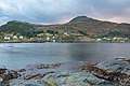 Husevåg and Mt. Rønelden (321m)
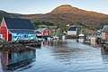 The harbour in Husevåg
 The harbour in Husevåg
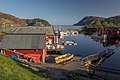 The harbour in Husevåg
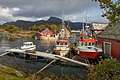 Fishing boats in Husevåg
 Houses in Husevåg
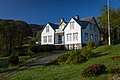 Husevåg
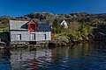 Husevåg
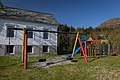 The old school in Husevåg
 Hovdeneset
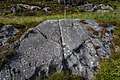 Petroglyps at Husevågøy
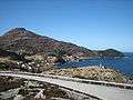 View of the small village of Husevåg on the northern island
 Panorama of the island
See also
References
- ↑ Store norske leksikon. "Husevågøy – øy i Nordfjord" (in Norwegian). Retrieved 2013-09-18.
This article is issued from
Wikipedia.
The text is licensed under Creative Commons - Attribution - Sharealike.
Additional terms may apply for the media files.