Hurst, Illinois
| Hurst, Illinois | |
|---|---|
| City | |
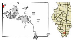 Location of Hurst in Williamson County, Illinois. | |
.svg.png) Location of Illinois in the United States | |
| Coordinates: 37°49′57″N 89°8′40″W / 37.83250°N 89.14444°WCoordinates: 37°49′57″N 89°8′40″W / 37.83250°N 89.14444°W | |
| Country | United States |
| State | Illinois |
| County | Williamson |
| Founded | 1903 |
| Government | |
| • Mayor | Duke Woolsey |
| Area[1] | |
| • Total | 0.86 sq mi (2.22 km2) |
| • Land | 0.85 sq mi (2.22 km2) |
| • Water | 0.00 sq mi (0.01 km2) |
| Population (2010) | |
| • Total | 795 |
| • Estimate (2016)[2] | 796 |
| • Density | 930.99/sq mi (359.30/km2) |
| Time zone | UTC-6 (CST) |
| • Summer (DST) | UTC-5 (CDT) |
| ZIP Code(s) | 62949 |
| Area code(s) | 618 |
| FIPS code | 17-36815 |
| Wikimedia Commons | Hurst, Illinois |
Hurst is a city in Williamson County, Illinois, United States. The population was 795 at the 2010 census.
Geography
Hurst is located at 37°49′57″N 89°8′40″W / 37.83250°N 89.14444°W (37.832366, -89.144475).[3]
According to the 2010 census, Hurst has a total area of 0.862 square miles (2.23 km2), of which 0.86 square miles (2.23 km2) (or 99.77%) is land and 0.002 square miles (0.01 km2) (or 0.23%) is water.[4]
Demographics
| Historical population | |||
|---|---|---|---|
| Census | Pop. | %± | |
| 1910 | 325 | — | |
| 1920 | 1,222 | 276.0% | |
| 1930 | 1,123 | −8.1% | |
| 1940 | 1,012 | −9.9% | |
| 1950 | 858 | −15.2% | |
| 1960 | 863 | 0.6% | |
| 1970 | 934 | 8.2% | |
| 1980 | 938 | 0.4% | |
| 1990 | 842 | −10.2% | |
| 2000 | 805 | −4.4% | |
| 2010 | 795 | −1.2% | |
| Est. 2016 | 796 | [2] | 0.1% |
| U.S. Census[5] | |||
As of the census[6] of 2000, there were 805 people, 360 households, and 217 families residing in the city. The population density was 935.1 people per square mile (361.4/km²). There were 386 housing units at an average density of 448.4 per square mile (173.3/km²). The racial makeup of the city was 97.27% White, 0.99% African American, 0.12% Native American, 0.87% from other races, and 0.75% from two or more races. Hispanic or Latino of any race were 1.24% of the population.
There were 360 households out of which 29.2% had children under the age of 18 living with them, 41.9% were married couples living together, 12.5% had a female householder with no husband present, and 39.7% were non-families. 36.1% of all households were made up of individuals and 17.5% had someone living alone who was 65 years of age or older. The average household size was 2.24 and the average family size was 2.89.
In the city, the population was spread out with 24.1% under the age of 18, 8.9% from 18 to 24, 29.1% from 25 to 44, 23.9% from 45 to 64, and 14.0% who were 65 years of age or older. The median age was 36 years. For every 100 females, there were 88.5 males. For every 100 females age 18 and over, there were 80.8 males.
The median income for a household in the city was $21,765, and the median income for a family was $30,250. Males had a median income of $24,659 versus $18,393 for females. The per capita income for the city was $12,583. About 18.7% of families and 24.8% of the population were below the poverty line, including 38.9% of those under age 18 and 14.8% of those age 65 or over.
Emergency services
The Hurst Fire Chief is Duke Woolsey and the ambulance director is Beverly Calvert. The fire and ambulance services are both fully volunteer organizations that boasts 19 firefighters and 7 EMT personnel. The Hurst EMA (Emergency Management Agency) director is Charles Colp. The Mayor is Duke Woolsey.
History
The City of Hurst was founded in 1903 by Thomas Philip Russell, named after his good friend and Union Pacific railroad engineer William Charles Hurst. The city of Hurst was a boastful small coal mining community from the 1900s until the early 1980s. After the closing of the coal mines, the city has diminished.
Education and religion
Hurst has 1 church in the community: a Christian church located on Russell Stree. After the closing of the Hurst-Bush Community Grade School in 1996 and the community high school in 1966, Hurst citizens attend Herrin Unit 4 schools.
References
- ↑ "2016 U.S. Gazetteer Files". United States Census Bureau. Retrieved Jun 29, 2017.
- 1 2 "Population and Housing Unit Estimates". Retrieved June 9, 2017.
- ↑ "US Gazetteer files: 2010, 2000, and 1990". United States Census Bureau. 2011-02-12. Retrieved 2011-04-23.
- ↑ "G001 - Geographic Identifiers - 2010 Census Summary File 1". United States Census Bureau. Retrieved 2015-12-27.
- ↑ Census of Population and Housing, U.S. Census Bureau, archived from the original on 2006-02-08
- ↑ "American FactFinder". United States Census Bureau. Retrieved 2008-01-31.
Municipalities and communities of Williamson County, Illinois, United States | ||
|---|---|---|
| Cities | ||
| Villages | ||
| Precincts | ||
| CDP | ||
| Other unincorporated communities |
| |
| Ghost towns | ||
| Footnotes | ‡This populated place also has portions in an adjacent county or counties | |