Huntington Township, Brown County, Ohio
| Huntington Township, Brown County, Ohio | |
|---|---|
| Township | |
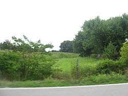 Fields north of Aberdeen | |
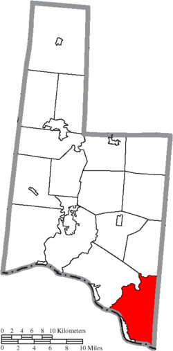 Location of Huntington Township in Brown County | |
| Coordinates: 38°41′21″N 83°45′30″W / 38.68917°N 83.75833°WCoordinates: 38°41′21″N 83°45′30″W / 38.68917°N 83.75833°W | |
| Country | United States |
| State | Ohio |
| County | Brown |
| Area | |
| • Total | 34.2 sq mi (88.6 km2) |
| • Land | 33.6 sq mi (87.0 km2) |
| • Water | 0.6 sq mi (1.6 km2) |
| Elevation[1] | 781 ft (238 m) |
| Population (2010) | |
| • Total | 2,763 |
| • Density | 82/sq mi (31.8/km2) |
| Time zone | UTC-5 (Eastern (EST)) |
| • Summer (DST) | UTC-4 (EDT) |
| FIPS code | 39-36834[2] |
| GNIS feature ID | 1085797[1] |
Huntington Township is one of the sixteen townships of Brown County, Ohio, United States. The 2010 census found 2,763 people in the township, 1,125 of whom lived in the unincorporated portions of the township.[3]
Geography
Located in the southeastern corner of the county along the Ohio River, it borders the following townships:
- Byrd Township - north
- Liberty Township, Adams County - northeast
- Sprigg Township, Adams County - east
- Union Township - northwest
- Mason County, Kentucky lies across the Ohio River to the southwest.
It is the most southerly township in Brown County.
The village of Aberdeen is located in southwestern Huntington Township, along the Ohio River.
Name and history
Huntington Township is named for Samuel Huntington, signer of the Declaration of Independence.[4]
Statewide, other Huntington Townships are located in Gallia, Lorain, and Ross counties.
Government
The township is governed by a three-member board of trustees, who are elected in November of odd-numbered years to a four-year term beginning on the following January 1. Two are elected in the year after the presidential election and one is elected in the year before it. There is also an elected township fiscal officer,[5] who serves a four-year term beginning on April 1 of the year after the election, which is held in November of the year before the presidential election. Vacancies in the fiscal officership or on the board of trustees are filled by the remaining trustees.
References
- 1 2 "US Board on Geographic Names". United States Geological Survey. 2007-10-25. Retrieved 2008-01-31.
- ↑ "American FactFinder". United States Census Bureau. Archived from the original on September 11, 2013. Retrieved 2008-01-31.
- ↑ "Geographic Identifiers: 2010 Demographic Profile Data (G001): Huntington township, Brown County, Ohio". U.S. Census Bureau, American Factfinder. Retrieved February 20, 2014.
- ↑ The History of Brown County, Ohio: Containing a History of the County, Its Townships, Towns, Churches, Schools, Etc. Higginson Book Company. 1883. p. 493.
- ↑ §503.24, §505.01, and §507.01 of the Ohio Revised Code. Accessed 4/30/2009.
External links
Municipalities and communities of Brown County, Ohio, United States | ||
|---|---|---|
| Villages | 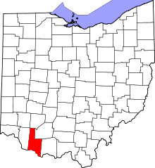 | |
| Townships | ||
| CDPs | ||
| Unincorporated communities | ||
| Footnotes | ‡This populated place also has portions in an adjacent county or counties | |