Appila, South Australia
| Appila South Australia | |||||||||||||||
|---|---|---|---|---|---|---|---|---|---|---|---|---|---|---|---|
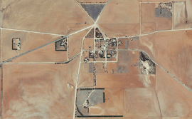 Aerial view of Appila, 2015 | |||||||||||||||
 Appila Location in South Australia | |||||||||||||||
| Coordinates | 33°3′2″S 138°25′41″E / 33.05056°S 138.42806°ECoordinates: 33°3′2″S 138°25′41″E / 33.05056°S 138.42806°E | ||||||||||||||
| Established | 1874 | ||||||||||||||
| Postcode(s) | 5480 | ||||||||||||||
| Location |
| ||||||||||||||
| LGA(s) | Mount Remarkable | ||||||||||||||
| State electorate(s) | Stuart | ||||||||||||||
| Federal Division(s) | Grey | ||||||||||||||
| |||||||||||||||
Appila (earlier known as Yarrowie) is a locality in the Mid North of South Australia east of the lower Flinders Ranges. It occupies much of the eastern half of the Hundred of Appila and a strip on the western side of the adjacent Hundred of Tarcowie.[1]
When the Lutheran school was closed by the state government in 1918, it had 33 students.[2]
.jpg)
Appila shown at the eastern edge of the Hundred of Appila on a 1964 cadastral map
See also
External links
- Klaassen, Nic. "Appila". Flinders Ranges Research.
References
- ↑ "Search result for "Appila" (Record ID SA0055826)". Geoscience Australia. Retrieved 16 May 2015.
- ↑ "CLOSING GERMAN SCHOOLS". The Express And Telegraph. LIV, (16, 152). South Australia. 12 June 1917. p. 3 (SPECIAL WAR EDITION). Retrieved 22 July 2017 – via National Library of Australia.
This article is issued from
Wikipedia.
The text is licensed under Creative Commons - Attribution - Sharealike.
Additional terms may apply for the media files.