Hoxton Park, New South Wales
| Hoxton Park Sydney, New South Wales | |||||||||||||||
|---|---|---|---|---|---|---|---|---|---|---|---|---|---|---|---|
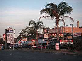 Hoxton Park Shopping Centre | |||||||||||||||
|
Hoxton Park | |||||||||||||||
| Coordinates | 33°56′2″S 150°51′10″E / 33.93389°S 150.85278°ECoordinates: 33°56′2″S 150°51′10″E / 33.93389°S 150.85278°E | ||||||||||||||
| Population | 4,355 (2016 census)[1] | ||||||||||||||
| Postcode(s) | 2171 | ||||||||||||||
| Location | 38 km (24 mi) west of Sydney | ||||||||||||||
| LGA(s) | City of Liverpool | ||||||||||||||
| State electorate(s) | Liverpool | ||||||||||||||
| Federal Division(s) | Werriwa | ||||||||||||||
| |||||||||||||||
Hoxton Park is a suburb of Sydney, in the state of New South Wales, Australia. Hoxton Park is located 38 kilometres west of the Sydney central business district, in the local government area of the City of Liverpool and is part of the Greater Western Sydney region.
Hoxton Park also had a small sealed airstrip, Hoxton Park Airport which was used for general aviation and training until its closure and destruction in 2008.
History
Hoxton Park was named in 1887 when Phillips and Co. syndicates, subdivided the land under that name. Thomas Setrop Amos, a London solicitor, who arrived in Sydney in 1816, was granted 800 acres (3.2 km2) here in June 1818.[2]
A further development of note took place circa 1857 with the construction of Bernera, a weatherboard homestead built by Allan Macpherson, son of a former Collector of Internal Revenue, William Macpherson. Bernera was an early homestead in a vernacular style and is listed on the Register of the National Estate.[3]
Population
In 2016, there were 4,355 residents in Hoxton Park. The median age of people in Hoxton Park was 32 years. Children aged 0 - 14 years made up 24.4% of the population and people aged 65 years and over made up 6.8% of the population. 50.9% of people were born in Australia. The most common countries of birth were Fiji 7.2%, Iraq 6.6%, Philippines 2.8%, Vietnam 2.8% and New Zealand 2.3%. 37.4% of people only spoke English at home. Other languages spoken at home included Arabic 9.1%, Hindi 8.5%, Assyrian Neo-Aramaic 4.0%, Vietnamese 3.8% and Spanish 3.4%.
Transport
Hoxton Park sits at the corner of Hoxton Park Road and Cowpasture Road which connect to the Westlink M7 and much of greater Sydney. Interline provides four bus services running along both Hoxton Park Road and Cowpasture Road, connecting Hoxton Park to Liverpool and areas to the west.[4]
Churches
Hoxton Park has many churches including Inspire Church, which has been active for more than 25 years with more than 5,000 members and also Bible Baptist Church which started in 1992.
Sport and recreation
Hoxton Park is home to the Liverpool Catholic Club which has an ice skating complex nearby.
See also
References
- ↑ Australian Bureau of Statistics (27 June 2017). "Hoxton Park (State Suburb)". 2016 Census QuickStats. Retrieved 12 May 2017.

- ↑ The Book of Sydney Suburbs, Compiled by Frances Pollon, Angus & Robertson Publishers, 1990, page 126 ISBN 0-207-14495-8
- ↑ The Heritage of Australia, Macmillan Company, 1981, p.2/41
- ↑ "Interline Network Map". Busabout. Archived from the original on 2007-08-30. Retrieved 2008-04-19.
| Wikimedia Commons has media related to Hoxton Park, New South Wales. |