Hot Springs, Virginia
| Hot Springs | |
|---|---|
| Census-designated place (CDP) | |
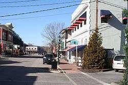 Downtown Hot Springs | |
 Hot Springs Location within the state of Virginia | |
| Coordinates: 38°2′46″N 79°47′26″W / 38.04611°N 79.79056°WCoordinates: 38°2′46″N 79°47′26″W / 38.04611°N 79.79056°W | |
| Country | United States |
| State | Virginia |
| County | Bath |
| Population (2010) | |
| • Total | 738 |
| Time zone | UTC−5 (Eastern (EST)) |
| • Summer (DST) | UTC−4 (EDT) |
| ZIP codes | 24445 |
Hot Springs is a census-designated place (CDP) in Bath County, Virginia, United States. The population as of the 2010 Census was 738.[1] It is located about 5 miles (8.0 kilometers) southwest of Warm Springs on U.S. Route 220.
Hot Springs has several historic resorts, for the springs helped develop Bath County. Since at least the mid 18th century, travelers came to use the springs. Thomas Bullitt built the first inn to accommodate them in 1766 and Dr. Thomas Goode expanded it. The most prominent modern resort, The Homestead, traces its origin to this inn. Mustoe House, The Yard, Barton Lodge, Switchback School, and Garth Newel are also listed on the National Register of Historic Places.[2][3][4]

Downtown Hot Springs from above
References
- ↑ Virginia Trend Report 2: State and Complete Places (Sub-state 2010 Census Data). Missouri Census Data Center. Accessed 2011-06-08.
- ↑ National Park Service (2010-07-09). "National Register Information System". National Register of Historic Places. National Park Service.
- ↑ "National Register of Historic Places Listings". Weekly List of Actions Taken on Properties: 6/17/13 through 6/21/13. National Park Service. 2013-06-28.
- ↑ "National Register of Historic Places Listings". Weekly List of Actions Taken on Properties: 12/23/13 through 12/27/13. National Park Service. 2014-01-03.
External links
| Wikimedia Commons has media related to Hot Springs, Virginia. |
| Wikisource has the text of a 1911 Encyclopædia Britannica article about Hot Springs, Virginia. |
- The Homestead Spa at Hot Springs
- Vine Cottage Inn at Hot Springs
- "Taking the Waters: 19th Century Medicinal Springs: Hot Springs." Claude Moore Health Sciences Library, University of Virginia
Municipalities and communities of Bath County, Virginia, United States | ||
|---|---|---|
| CDPs |  | |
| Unincorporated communities |
| |
| Footnotes | ‡This populated place also has portions in an adjacent county or counties | |
This article is issued from
Wikipedia.
The text is licensed under Creative Commons - Attribution - Sharealike.
Additional terms may apply for the media files.