Hopetoun Park, Victoria
| Hopetoun Park Bacchus Marsh, Victoria | |||||||||||||||
|---|---|---|---|---|---|---|---|---|---|---|---|---|---|---|---|
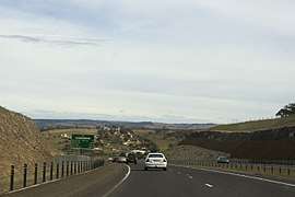 The Western Freeway passing through Hopetoun Park | |||||||||||||||
 Hopetoun Park | |||||||||||||||
| Coordinates | 37°41′09″S 144°29′57″E / 37.68583°S 144.49917°ECoordinates: 37°41′09″S 144°29′57″E / 37.68583°S 144.49917°E | ||||||||||||||
| Population | 798 (2016 census)[1] | ||||||||||||||
| Postcode(s) | 3340 | ||||||||||||||
| Location |
| ||||||||||||||
| LGA(s) | Shire of Moorabool | ||||||||||||||
| State electorate(s) | Melton | ||||||||||||||
| Federal Division(s) | Ballarat | ||||||||||||||
| |||||||||||||||
Hopetoun is a rural residential suburb of Bacchus Marsh, a peri-urban town in central Victoria, Australia. The locality consists of the area between the Bacchus Marsh urban area and Melton, north of the Werribee River (Melton Reservoir) and south of the Western Highway. It is in the Shire of Moorabool, 51 kilometres (32 mi) west north west of the state capital, Melbourne.
At the 2016 census, Hopetoun Park had a population of 798.[1]
References
- 1 2 Australian Bureau of Statistics (27 June 2017). "Hopetoun Park". 2016 Census QuickStats. Retrieved 22 July 2017.

External links
![]()
This article is issued from
Wikipedia.
The text is licensed under Creative Commons - Attribution - Sharealike.
Additional terms may apply for the media files.