Hoot Owl, Oklahoma
| Hoot Owl, Oklahoma | |
|---|---|
| Town | |
 Hoot Owl, Oklahoma Location within the state of Oklahoma | |
| Coordinates: 36°21′36″N 95°7′18″W / 36.36000°N 95.12167°W | |
| Country | United States |
| State | Oklahoma |
| County | Mayes |
| Area | |
| • Total | 0.1 sq mi (0.2 km2) |
| • Land | 0.1 sq mi (0.2 km2) |
| • Water | 0.0 sq mi (0.0 km2) |
| Elevation | 709 ft (216 m) |
| Population (2010) | |
| • Total | 4 |
| Time zone | UTC-6 (Central (CST)) |
| • Summer (DST) | UTC-5 (CDT) |
| FIPS code | 40-36020[1] |
| GNIS feature ID | 1102939[2] |
Hoot Owl is a town in Mayes County, Oklahoma, United States. As of the 2000 census, the town had a total population of zero (5 in 1990). By 2010, the population had risen to 4.[3]
Geography
According to the United States Census Bureau, the town has a total area of 0.1 square miles (0.26 km2), of which, 0.1 square miles (0.26 km2) of it is land and none of the area is covered with water. The town is located at 36.35995 N, 95.12137 W.
Hoot Owl is located on the eastern shore of Lake Hudson.
Demographics
| Historical population | |||
|---|---|---|---|
| Census | Pop. | %± | |
| 1980 | 3 | — | |
| 1990 | 5 | 66.7% | |
| 2000 | 1 | −80.0% | |
| 2010 | 4 | 300.0% | |
| Est. 2015 | 4 | [4] | 0.0% |
| U.S. Decennial Census[5] | |||
As of the census[1] of 2010, there were 4 people living in the town.
References
- 1 2 "American FactFinder". United States Census Bureau. Retrieved 2008-01-31.
- ↑ "US Board on Geographic Names". United States Geological Survey. 2007-10-25. Retrieved 2008-01-31.
- ↑ "American FactFinder". U.S. Census Bureau. Retrieved 4 March 2011.
- ↑ "Annual Estimates of the Resident Population for Incorporated Places: April 1, 2010 to July 1, 2015". Archived from the original on June 2, 2016. Retrieved July 2, 2016.
- ↑ "Census of Population and Housing". Census.gov. Archived from the original on May 12, 2015. Retrieved June 4, 2015.
Coordinates: 36°21′36″N 95°07′18″W / 36.360034°N 95.12161°W
Municipalities and communities of Mayes County, Oklahoma, United States | ||
|---|---|---|
| City | 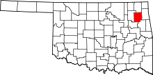 | |
| Towns | ||
| CDPs | ||
| Unincorporated communities |
| |
| Footnotes | ‡This populated place also has portions in an adjacent county or counties | |
This article is issued from
Wikipedia.
The text is licensed under Creative Commons - Attribution - Sharealike.
Additional terms may apply for the media files.