Hoher Burgstall (Kalkkögel)
| Hoher Burgstall | |
|---|---|
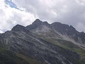 The Hoher Burgstall seen from the Kreuzjoch saddle | |
| Highest point | |
| Elevation | 2,611 m (AA) (8,566 ft) |
| Prominence | 155 m ↓ Schlicker Scharte |
| Isolation | 1.4 km → Schlicker Seespitze |
| Coordinates | 47°07′59″N 11°16′47″E / 47.13306°N 11.27972°ECoordinates: 47°07′59″N 11°16′47″E / 47.13306°N 11.27972°E |
| Geography | |
| Parent range | Kalkkögel, Stubai Alps |
| Geology | |
| Mountain type | Rocky summit |
| Type of rock | Limestone |
| Climbing | |
| Normal route | From the south via the Starkenburg Hut |

The Hoher Burgstall is a mountain, 2,611 m, in the Kalkkögel in the Stubai Alps, southeast of the Schlicker Seespitze (2,804 m). Its summit offers a good view into the Oberbergtal, the upper Stubaital, the Serles ridge and the Kalkkögeln.
Ascents
The summit is accessible from Starkenburger Hut to the south.[1]
From the north, a rocky gully leads to the top: from the Schlick a well signed path climbs to the Sennjoch saddle. The route continues uphill to the Burgstalljoch and on the path to the Schlicker Scharte wind gap, left through the rock gully to the summit. Alternatively the rock gully can be accessed from the Schlicker Scharte.
The Central Alpine Way 02A runs across the western flank of the Hoher Burgstall.
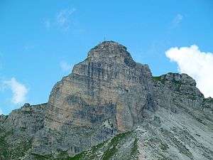 View from the Niederer Burgstall
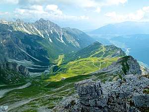 View from the Hoher Burgstall
 View towards the Elfer
References
- ↑ "Hoher Burgstall". Meinstubaital.at (in German). Retrieved 2014-12-13.
External links

This article is issued from
Wikipedia.
The text is licensed under Creative Commons - Attribution - Sharealike.
Additional terms may apply for the media files.