Hofheim, Bavaria
| Hofheim, Bavaria | ||
|---|---|---|
| ||
 Hofheim, Bavaria Location of Hofheim, Bavaria within Haßberge district 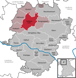 | ||
| Coordinates: 50°8′N 10°11′E / 50.133°N 10.183°ECoordinates: 50°8′N 10°11′E / 50.133°N 10.183°E | ||
| Country | Germany | |
| State | Bavaria | |
| Admin. region | Unterfranken | |
| District | Haßberge | |
| Government | ||
| • Mayor | Wolfgang Borst (CSU) | |
| Area | ||
| • Total | 56.35 km2 (21.76 sq mi) | |
| Elevation | 250 m (820 ft) | |
| Population (2017-12-31)[1] | ||
| • Total | 5,126 | |
| • Density | 91/km2 (240/sq mi) | |
| Time zone | CET/CEST (UTC+1/+2) | |
| Postal codes | 97461 | |
| Dialling codes | 09523 | |
| Vehicle registration | HAS | |
| Website | www.stadt-hofheim.de | |

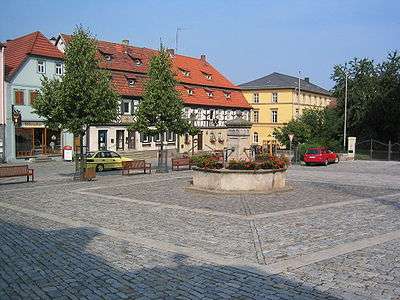
Market square with fountain
Hofheim in Unterfranken is a city located in the district of Haßberge, Unterfranken, Bavaria in Germany.
The municipality consists of the City of Hofheim and the villages of Eichelsdorf, Erlsdorf, Goßmannsdorf, Lendershausen, Manau, Ostheim, Reckertshausen, Rügheim and Sulzbach.
Between 1892 and 1995 it also had a branch line to Haßfurt.
Major trades are farming, gardening, fruit-growing, and small industry like metal- and textile-processing and brewing.
References
- ↑ "Fortschreibung des Bevölkerungsstandes". Bayerisches Landesamt für Statistik und Datenverarbeitung (in German). September 2018.
Towns and municipalities in Haßberge (district) | ||
|---|---|---|
This article is issued from
Wikipedia.
The text is licensed under Creative Commons - Attribution - Sharealike.
Additional terms may apply for the media files.