Hochstetter Bay
| Hochstetter Bay | |
|---|---|
| Hochstetterbugten | |
 Hochstetter Bay Location in Greenland | |
| Location | Arctic |
| Coordinates | 74°53′N 18°45′W / 74.883°N 18.750°WCoordinates: 74°53′N 18°45′W / 74.883°N 18.750°W |
| Ocean/sea sources | Greenland Sea |
| Basin countries | Greenland |
Hochstetter Bay (Danish: Hochstetterbugten) is a broad bay in northeastern Greenland. It is part of the Northeast Greenland National Park area.
The name is said to have been in use from 1929 by Danish hunters, and first appeared on the maps of the 1932 Gefion Expedition.[1]
Geography
This bay is located between Hochstetter Foreland and Shannon Island to the north, Kuhn Island to the west, and Wollaston Foreland and the Pendulum Islands to the south. To the east, the bay opens to the Greenland Sea.[2]
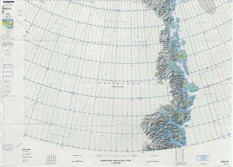
Map of Northeastern Greenland
References
- ↑ "Maps of East Greenland". Archived from the original on 2008-12-27. Retrieved 2008-11-30.
- ↑ "Hochstetterbugten". Mapcarta. Retrieved 18 June 2016.
This article is issued from
Wikipedia.
The text is licensed under Creative Commons - Attribution - Sharealike.
Additional terms may apply for the media files.