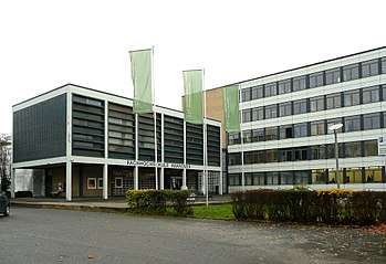
Hochschule Hannover
The Hochschule Hannover (HsH) is a public Fachhochschule (University of Applied Sciences and Arts) in Hanover. It's the second largest university in Hanover with 9600 enrolled students in the winter term 2014/2015 and 620 professors and employees. In addition there are around 430 guestlecturers from other academic institutes, organisations and companies teaching at the HsH.[1] [2] The Hochschule Hannover has four locations (main campus Ricklinger Stadtweg in Hannover-Linden, EXPO-Plaza, Blumhardtstraße in Hannover-Kleefeld and Heisterbergallee in Hannover-Ahlem).
History
In 1971 the Fachhochschule Hannover was founded as successor of several educational institutions, amongst others the "Freye Handwerksschule für Lehrlinge" and the "Königlich Hannoversche Baugewerkschule zu Nienburg/Weser". In 2007 the Evangelische Fachhochschule Hannover (Evangelical University of Applied Sciences) was incorporated as a fifth faculty.
Since 2010 the name of the university was changed to Hochschule Hannover.[3] In 2010 the degree program "Fotojournalismus und Dokumentarfotografie" with the English name "Photojournalism and Documentary Photography" was accredited by the organization ACQUIN. The HsH belongs with this core profile to the major international photographic educational institutes.[4] The current president of the Hochschule Hannover is Josef von Helden.
Cooperations
The HsH cooperates with diverse institutions such as Aalborg University, the Hogeschool Gent, and a wide range of partners in industry.[5]
List of Faculties
- Faculty I – Electrical Engineering and Information Technology (location Hannover-Linden)
- Faculty II – Mechanical and Bio Process Engineering (location Hannover-Linden and Hannover-Ahlem)
- Faculty III – Media, Information and Design (location EXPO-Plaza)
- Faculty IV – Business and Computer Science (location Hannover-Linden)
- Faculty V – Social Welfare Work and Health Care (location Hannover-Kleefeld)
External links
| Wikimedia Commons has media related to Category:Hochschule Hannover. |
References
- ↑ Profile of the University of Applied Sciences and Arts in Hanover
- ↑ Hochschule Hannover in Zahlen
- ↑ Hochschule statt Fachhochschule - Umbenennung der FH sorgt für Verwirrung (in German)
- ↑ Studiengang Fotojournalismus und Dokumentarfotografie akkreditiert (in German)
- ↑ Fachhochschule Hannover (FHH) : University of Applied Sciences and Arts (bilingual guide)
Coordinates: 52°21′13″N 9°43′27″E / 52.353611°N 9.724167°E
| Authority control |
|---|