Hippo Island
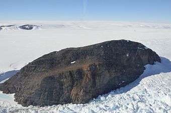
Hippo Island from the north.
Hippo Island (66°25′S 98°10′E / 66.417°S 98.167°ECoordinates: 66°25′S 98°10′E / 66.417°S 98.167°E) is a steep, rocky island, 0.5 nautical miles (1 km) long, which rises above the Shackleton Ice Shelf of Antarctica 1.5 nautical miles (3 km) north of Delay Point. It was discovered by the Western Base Party of the Australasian Antarctic Expedition under Mawson, 1911–14, who so named it because of its hippo-like shape.[1]
See also
References
- ↑ "Hippo Island". Geographic Names Information System. United States Geological Survey. Retrieved 2012-06-18.
![]()
This article is issued from
Wikipedia.
The text is licensed under Creative Commons - Attribution - Sharealike.
Additional terms may apply for the media files.