Hinterer Brochkogel
| Hinterer Brochkogel | |
|---|---|
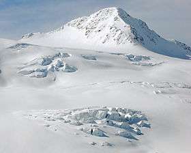 Hinterer Brochkogel from NE over the Taschachferner | |
| Highest point | |
| Elevation | 3,635 m (11,926 ft) |
| Prominence | 153 m (502 ft) |
| Isolation | 0.9 kilometres (0.56 mi) |
| Parent peak | Wildspitze |
| Coordinates | 46°53′10″N 10°50′59″E / 46.88611°N 10.84972°ECoordinates: 46°53′10″N 10°50′59″E / 46.88611°N 10.84972°E |
| Geography | |
| Parent range | Ötztal Alps |
| Climbing | |
| First ascent | 2 Aug 1858 by Leander Klotz, Albert Wachtler |
| Easiest route | Southeast ridge from the Breslauer Hütte |

The Hinterer Brochkogel (German pronunciation: [ˈhɪntəʀɐ ˈbʀɔχˌkoːɡl̩] (![]()
This article is issued from
Wikipedia.
The text is licensed under Creative Commons - Attribution - Sharealike.
Additional terms may apply for the media files.