Hiji, Ōita
| Hiji 日出町 | |||
|---|---|---|---|
| Town | |||
| |||
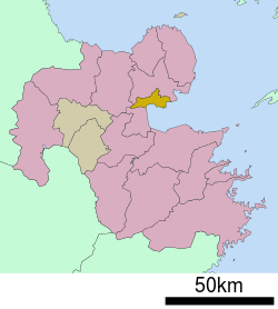 Location of Hiji in Ōita Prefecture | |||
 Hiji Location in Japan | |||
| Coordinates: 33°22′N 131°32′E / 33.367°N 131.533°ECoordinates: 33°22′N 131°32′E / 33.367°N 131.533°E | |||
| Country | Japan | ||
| Region | Kyushu | ||
| Prefecture | Ōita Prefecture | ||
| District | Hayami | ||
| Area | |||
| • Total | 73.32 km2 (28.31 sq mi) | ||
| Population (March 31, 2017) | |||
| • Total | 28,524 | ||
| • Density | 390/km2 (1,000/sq mi) | ||
| Time zone | UTC+9 (JST) | ||
| Website |
www | ||


Hiji (日出町 Hiji-machi) is a town located in Hayami District, Ōita Prefecture, Japan.
As of March 2017, the town has an estimated population of 28,524 and the density of 390 persons per km². The total area is 73.32 km².[1]
Geography
Hiji is located within the eastern part of Ōita Prefecture and borders with the Beppu Bay.
Neigbouring municipalities
Transportation
Railway
Highways
- Ōita Expressway
- Higashikyushu Expressway
- Japan national routes
Places of interests
The town has a trappist monastery and is also the home of Sanrio's Harmonyland theme park.
References
- ↑ "Official website of Hiji town" (in Japanese). Japan: Hiji town. Retrieved 22 April 2017.
External links

- Town of Hiji (in Japanese)
| Core city | ||
|---|---|---|
| Cities | ||
| Districts | ||
This article is issued from
Wikipedia.
The text is licensed under Creative Commons - Attribution - Sharealike.
Additional terms may apply for the media files.