Hiiumaa
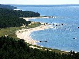 Tahkuna peninsula is the most northern part of Hiiumaa | |
.jpg) | |
| Geography | |
|---|---|
| Location | Baltic Sea |
| Coordinates | Coordinates: 58°53′03″N 22°38′40″E / 58.88417°N 22.64444°E |
| Archipelago | West Estonian archipelago |
| Area | 989 km2 (382 sq mi) |
| Highest elevation | 68 m (223 ft) |
| Highest point | Tornimägi |
| Administration | |
|
Estonia | |
| County, Parish | Hiiu County, Hiiumaa Parish |
| Largest settlement | Kärdla (pop. 3,287 (01.01.2012)[1]) |
| Demographics | |
| Population | 8,582 |
| Pop. density | 8.7 /km2 (22.5 /sq mi) |
Hiiumaa (Estonian pronunciation: [ˈhiːumɑː]; Swedish & German: Dagö; Danish: Dagø; Finnish: Hiidenmaa) is the second largest island (989 km²) in Estonia. It is in the Baltic Sea, north of the island of Saaremaa, part of the West Estonian archipelago. Its largest town is Kärdla. Along with several smaller neighboring islands, the island makes up Hiiu County; one of the 15 counties of Estonia.
The Hiiu Shoal (Nekmangrund) is located off the northwestern shore of Hiiumaa Island.
Names
Hiiumaa is the main island of Hiiu County, called Hiiumaa or Hiiu maakond in Estonian. The Swedish and German name of the island is Dagö ("Day" island), Dagø in Danish. In modern Finnish, it is called Hiidenmaa, literally Hiisi's Land. In Old Gutnish, it was Dagaiþ (day isthmus), from which the local North Germanic name "Daë" is derived.
History
Archaeological evidence of the first human settlement in Hiiumaa dates to the 4th century BC. The first documented record of the island of Dageida was made by contemporary chroniclers in 1228, when Hiiumaa and the rest of Estonia were conquered by Germanic crusaders. In 1254, Hiiumaa was divided between the Bishopric of Ösel-Wiek and the Livonian branch of the Teutonic Order, acting partly on behalf of the Hanseatic League.
The island was part of Swedish Estonia from 1563 to 1721, after which it passed to the Russian Empire as part of the Governorate of Estonia, though Dagö's Swedish population kept most of their privileges. Most of the island's previously numerous Swedish-speaking population emigrated or were "Estonianised" during the period of Imperial Russian rule, although a minority remains to this day. Estonian Swedes are also known as "aibofolke" (meaning island people in Swedish) or "rannarootslased" (meaning coastal Swedes in Estonian).
World War I
Hiiumaa was occupied during World War I by the Imperial German Army, in Operation Albion. After the war, it became a part of independent Estonia.
World War II
The waters near Hiiumaa were active during World War II:[2]
- 23 June 1941- The Soviet destroyer Gnevny was sunk by a German seamine.
- 25 June- the Soviet minesweeper T-208 Shkiv was destroyed by a German seamine.
- 27 June- Two German motor torpedo boats, S43 and S106, were destroyed by Soviet seamines.
- 1 July- the Soviet submarine M-81 was destroyed by a German seamine north of Hiiumaa.
- 7 July- the Soviet minesweeper T-216 was sunk.
- 30 July- the Soviet minesweeper T-201 Zarjad was sunk.
- 10 August- the German submarine U-144 was sunk by a torpedo from the Soviet submarine SC-307.
Hiiumaa Island was annexed by the Soviet Union in 1940, by Nazi Germany in 1941, and by the Soviets again in 1944. It was part of the Estonian Soviet Socialist Republic until the Soviet Union collapsed in 1991. During the Soviet era, Hiiumaa was declared a restricted zone, closed to foreigners and to most mainland Estonians. Since 1991, the island has been a part of independent Estonia.
Geography
Hiiumaa is an island in Estonia located north of Saaremaa in the Baltic Sea. It is the northernmost island in the Muhu archipelago, which includes Saaremaa and Muhu. The Soela Strait separates Hiiumaa from Saaremaa to its south, and the Muhu Strait separates it from the mainland of Estonia.[3]
Transport
Road transport from Estonian mainland to Hiiumaa involves a 90-minute (28 km) ferry crossing from Rohuküla to Heltermaa, which is 25 km by road from Kärdla. There are about 10 ferry departures a day operated by TS Laevad.[4] In the summer weekends, getting car space on the ferry usually requires advance booking. There are about 2 scheduled buses a day between Tallinn (the capital of Estonia) and Kärdla.[5] In the winter, the island can be reached, conditions permitting, via a 26.5 km ice road (the longest in Europe) across the frozen Baltic Sea.[6][7]
Hiiumaa is served by Kärdla Airport, with regular flights to Tallinn. Bicycle rental is also available in Kärdla and there is a good bicycle path built from Kärdla towards Kõrgessaare.
Climate
| Climate data for Hiiumaa (Ristna, located in western part of the island) | |||||||||||||
|---|---|---|---|---|---|---|---|---|---|---|---|---|---|
| Month | Jan | Feb | Mar | Apr | May | Jun | Jul | Aug | Sep | Oct | Nov | Dec | Year |
| Record high °C (°F) | 8.4 (47.1) |
7.1 (44.8) |
13.5 (56.3) |
21.5 (70.7) |
27.8 (82) |
28.0 (82.4) |
31.5 (88.7) |
31.0 (87.8) |
24.6 (76.3) |
17.9 (64.2) |
11.5 (52.7) |
9.6 (49.3) |
31.5 (88.7) |
| Average high °C (°F) | 0.9 (33.6) |
−0.2 (31.6) |
2.0 (35.6) |
6.8 (44.2) |
12.3 (54.1) |
16.4 (61.5) |
20.2 (68.4) |
20.0 (68) |
15.1 (59.2) |
10.2 (50.4) |
5.3 (41.5) |
2.5 (36.5) |
9.3 (48.7) |
| Daily mean °C (°F) | −0.9 (30.4) |
−2.1 (28.2) |
−0.1 (31.8) |
3.7 (38.7) |
8.7 (47.7) |
13.1 (55.6) |
17.0 (62.6) |
16.8 (62.2) |
12.7 (54.9) |
8.3 (46.9) |
3.6 (38.5) |
0.8 (33.4) |
6.8 (44.2) |
| Average low °C (°F) | −3 (27) |
−4.4 (24.1) |
−2.4 (27.7) |
0.9 (33.6) |
5.4 (41.7) |
10.1 (50.2) |
14.1 (57.4) |
13.8 (56.8) |
9.9 (49.8) |
6.0 (42.8) |
1.6 (34.9) |
−1.3 (29.7) |
4.2 (39.6) |
| Record low °C (°F) | −28.4 (−19.1) |
−24.9 (−12.8) |
−19.9 (−3.8) |
−9.1 (15.6) |
−3 (27) |
0.6 (33.1) |
5.9 (42.6) |
4.6 (40.3) |
−2.3 (27.9) |
−5.6 (21.9) |
−15.1 (4.8) |
−17.3 (0.9) |
−28.4 (−19.1) |
| Average precipitation mm (inches) | 55 (2.17) |
39 (1.54) |
37 (1.46) |
31 (1.22) |
33 (1.3) |
47 (1.85) |
55 (2.17) |
69 (2.72) |
62 (2.44) |
72 (2.83) |
79 (3.11) |
60 (2.36) |
639 (25.16) |
| Average relative humidity (%) | 85 | 85 | 84 | 81 | 79 | 81 | 81 | 81 | 81 | 82 | 84 | 84 | 82 |
| Mean monthly sunshine hours | 28.2 | 59.3 | 119.4 | 190.9 | 293.1 | 297.6 | 303.2 | 251.0 | 166.2 | 96.1 | 36.3 | 19.0 | 1,864.4 |
| Source: Estonian Weather Service (sun, 1971–2000)[8][9][10][11] | |||||||||||||
Cuisine
Smoke cooked plaice is a traditional summer time delicacy.
Notables
- Aleksander Maaker (1890-1968), the last traditional player of the torupill (Estonian bagpipe)
- Juhan Maaker (1845-1930), Estonian folk musician
- Lydia Mei (1896-1965), Estonian artist
- Natalie Mei (1900-1975), Estonian artist
- Erkki-Sven Tüür (b. 1959), Estonian composer of contemporary classical music.
- Roman von Ungern-Sternberg (1885-1921), White military commander in the Russian Civil War.
Image gallery
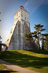
Tahkuna lighthouse 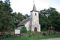
Church of Kassari 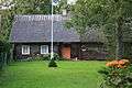
Old farmhouse 
Sõru museum 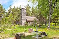
Malvaste chapel 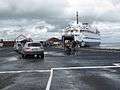 Cars boarding the ferry to mainland at Heltermaa
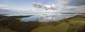 Coast of Hiiumaa
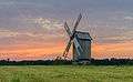 Tubala windmill
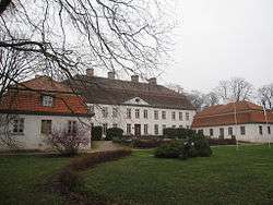 Suuremõisa Manor in Suuremõisa, Pühalepa Parish
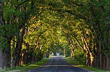 Avenue at Suuremõisa Park
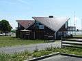 Café at Orjaku Harbor
 Nature trail near Orjaku
See also
References
- ↑ Comparison of self-government units, Statistical Council's Regional Portal (checked November 7th, 2012)
- ↑ Jorma Mäntykoski, Kalevi Keskinen (1991). The Finnish Navy At War in 1939-1945 (Suomen Laivasto Sodassa 1939-1945). Espoo: Tietoteos Ky. p. 154. ISBN 951-8919-05-4.
- ↑ "Hiiumaa". Encyclopedia Britannica. https://www.britannica.com/place/Hiiumaa. Accessed 8 March 2017.
- ↑ Praamid.ee. Ferry schedules and booking.
- ↑ "Bus schedules and booking". BussiReisid. Archived from the original on 13 September 2008.
- ↑ Estonia claims Europe's longest ice highway. The Independent. 19 February 2011. Retrieved 19 February 2011.
- ↑ "BBC: No seatbelts allowed on Europe's longest ice road". Retrieved 18 February 2014.
- ↑ "Climate normals-Temperature". Estonian Weather Service. Retrieved 28 September 2016.
- ↑ "Climate normals-Precipitation". Estonian Weather Service. Retrieved 28 September 2016.
- ↑ "Climate normals-Humidity". Estonian Weather Service. Retrieved 28 September 2016.
- ↑ "Kliimanormid-Päikesepaiste kestus" (in Estonian). Estonian Weather Service. Archived from the original on 22 February 2012. Retrieved 28 September 2016.
External links
![]()

- Hiiumaa County government Official site
- Hiiumaa at Curlie (based on DMOZ)
- Pictures of Coastal batteries World War I and World War II in Hiiumaa Official site