High Country Rail Trail
The High Country Rail Trail is a 35 kilometre, part-gravel part-sealed rail trail on the northern border of Victoria, Australia. It runs along the former Cudgewa railway line from Wodonga, along the edge of Lake Hume, to a point just east of the Mitta Mitta River, including a 600-metre bridge over Sandy Creek Inlet.[1] There are plans to eventually extend the trail as far as Cudgewa near Corryong.
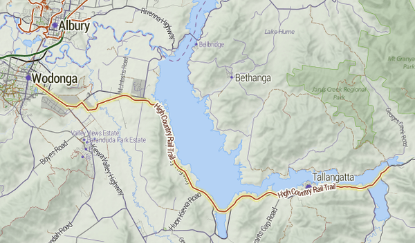
Map of the best developed section of the High Country Rail Trail.

The eastern section, around Koetong.
External links
- www.highcountryrailtrail.org.au - official site
- Trail map

References
- ↑ "High Country Rail Trail". Bicycle Network Victoria. Archived from the original on 2012-04-19.
This article is issued from
Wikipedia.
The text is licensed under Creative Commons - Attribution - Sharealike.
Additional terms may apply for the media files.