Hienghène
| Hienghène | |
|---|---|
| Commune | |
 "La Poule" (the hen) cliff in Hienghène | |
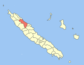 Location of the commune (in red) within New Caledonia | |
| Coordinates: 20°41′39″S 164°55′20″E / 20.6941°S 164.9222°ECoordinates: 20°41′39″S 164°55′20″E / 20.6941°S 164.9222°E | |
| Country | France |
| Sui generis collectivity | New Caledonia |
| Province | North Province |
| Government | |
| • Mayor | Daniel Goa |
| Area1 | 1,068.8 km2 (412.7 sq mi) |
| Population (2014 census)2 | 2,483 |
| • Density | 2.3/km2 (6.0/sq mi) |
| Ethnic distribution | |
| • 1996 census |
Kanaks 97.4% Europeans 2.6% Polynesians 0% Other 0% |
| INSEE/Postal code | 98807 /98815 |
| Elevation |
0–1,628 m (0–5,341 ft) (avg. 20 m or 66 ft) |
|
1 New Caledonia Land Register (DITTT) data, which exclude lakes and ponds larger than 1 km² (0.386 sq mi or 247 acres) as well as the estuaries of rivers. 2 Population without double counting: residents of multiple communes (e.g., students and military personnel) only counted once. | |
Hienghène is a commune in the North Province of New Caledonia, an overseas territory of France in the Pacific Ocean. It is located on a bay called Hienghène Bay, known for its eroded limestone islets.[1]
The islets are remnants of a limestone and silica formation that once covered the whole of the bay, some 40 million years ago.[1] Erosion from wind and water carved away the softer limestone, leaving the harder silica behind in eye-catching formations. Several of these formations have been given fanciful names, such as the Sphinx, the Towers of Notre Dame, and the Hen (pictured).[1]
References
| Wikimedia Commons has media related to Hienghène. |
| Provinces | |
|---|---|
| Communes | |
This article is issued from
Wikipedia.
The text is licensed under Creative Commons - Attribution - Sharealike.
Additional terms may apply for the media files.