Heskestad
| Heskestad | |
|---|---|
| Village | |
 View of the historic railway station in Heskestad | |
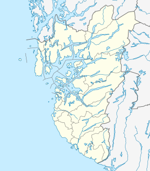 Heskestad Location in Rogaland county  Heskestad Heskestad (Norway) | |
| Coordinates: 58°29′52″N 06°21′33″E / 58.49778°N 6.35917°ECoordinates: 58°29′52″N 06°21′33″E / 58.49778°N 6.35917°E | |
| Country | Norway |
| Region | Western Norway |
| County | Rogaland |
| District | Dalane |
| Municipality | Lund |
| Elevation[1] | 194 m (636 ft) |
| Time zone | UTC+01:00 (CET) |
| • Summer (DST) | UTC+02:00 (CEST) |
| Post Code | 4463 Ualand |
Heskestad is a village in Lund municipality in Rogaland county, Norway. The village is located in the western part of Lund, along the European route E39 highway and the Sørlandet Line, about 15 kilometres (9.3 mi) northwest of the village of Moi. Heskestad Station is a now-closed railway station located in the village.
Heskestad is also a parish in the Church of Norway. Heskestad Church, dating back to 1904, is located in the village and it is the church for the parish, serving the western part of Lund.
Heskestad was the administrative centre of the municipality of Heskestad which existed from 1838 until 1965.[2]
References
- ↑ "Heskestad, Lund (Rogaland)" (in Norwegian). yr.no. Retrieved 2016-07-22.
- ↑ Store norske leksikon. "Heskestad" (in Norwegian). Retrieved 2016-07-22.
This article is issued from
Wikipedia.
The text is licensed under Creative Commons - Attribution - Sharealike.
Additional terms may apply for the media files.