Henrietta, Missouri
| Henrietta, Missouri | |
|---|---|
| City | |
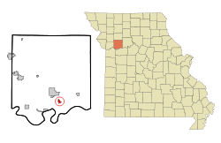 Location of Henrietta, Missouri | |
| Coordinates: 39°14′10″N 93°56′10″W / 39.23611°N 93.93611°WCoordinates: 39°14′10″N 93°56′10″W / 39.23611°N 93.93611°W | |
| Country | United States |
| State | Missouri |
| County | Ray |
| Area[1] | |
| • Total | 0.60 sq mi (1.55 km2) |
| • Land | 0.60 sq mi (1.55 km2) |
| • Water | 0 sq mi (0 km2) |
| Elevation | 705 ft (215 m) |
| Population (2010)[2] | |
| • Total | 369 |
| • Estimate (2016)[3] | 360 |
| • Density | 620/sq mi (240/km2) |
| Time zone | UTC-6 (Central (CST)) |
| • Summer (DST) | UTC-5 (CDT) |
| ZIP code | 64036 |
| Area code(s) | 816 |
| FIPS code | 29-31654[4] |
| GNIS feature ID | 0730116[5] |
Henrietta is a city in Ray County, Missouri, United States. The population was 369 at the 2010 census.[6]
History
Henrietta was platted in 1868, and named after Henrietta Watkins, the wife of a first settler.[7] A variant name was "Henry".[8] A post office called Henry was established in 1869, and the name was changed to Henrietta in 1908.[9]
Geography
Henrietta is located at 39°14′10″N 93°56′10″W / 39.23611°N 93.93611°W (39.236174, -93.936038),[10] in Ray County. Henrietta is 27 miles (43 km) east of Independence and 35 miles (56 km) east of Kansas City. Henrietta is part of the Kansas City metropolitan area.
According to the United States Census Bureau, the city has a total area of 0.60 square miles (1.55 km2), all land.[1]
Demographics
| Historical population | |||
|---|---|---|---|
| Census | Pop. | %± | |
| 1890 | 315 | — | |
| 1900 | 385 | 22.2% | |
| 1910 | 443 | 15.1% | |
| 1920 | 630 | 42.2% | |
| 1930 | 632 | 0.3% | |
| 1940 | 544 | −13.9% | |
| 1950 | 462 | −15.1% | |
| 1960 | 497 | 7.6% | |
| 1970 | 466 | −6.2% | |
| 1980 | 424 | −9.0% | |
| 1990 | 412 | −2.8% | |
| 2000 | 457 | 10.9% | |
| 2010 | 369 | −19.3% | |
| Est. 2016 | 360 | [3] | −2.4% |
| U.S. Decennial Census[11] | |||
2010 census
As of the census[2] of 2010, there were 369 people, 109 households, and 75 families residing in the city. The population density was 615.0 inhabitants per square mile (237.5/km2). There were 141 housing units at an average density of 235.0 per square mile (90.7/km2). The racial makeup of the city was 93.5% White, 5.4% African American, 0.5% Native American, 0.3% from other races, and 0.3% from two or more races. Hispanic or Latino of any race were 4.6% of the population.
There were 109 households of which 34.9% had children under the age of 18 living with them, 43.1% were married couples living together, 17.4% had a female householder with no husband present, 8.3% had a male householder with no wife present, and 31.2% were non-families. 22.9% of all households were made up of individuals and 7.4% had someone living alone who was 65 years of age or older. The average household size was 2.64 and the average family size was 3.03.
The median age in the city was 37.1 years. 21.4% of residents were under the age of 18; 11.9% were between the ages of 18 and 24; 29.5% were from 25 to 44; 27.1% were from 45 to 64; and 10% were 65 years of age or older. The gender makeup of the city was 55.8% male and 44.2% female.
2000 census
As of the census[4] of 2000, there were 457 people, 124 households, and 83 families residing in the city. The population density was 765.0 people per square mile (294.1/km²). There were 149 housing units at an average density of 249.4 per square mile (95.9/km²). The racial makeup of the city was 88.62% White, 7.00% African American, 0.66% Native American, 2.19% from other races, and 1.53% from two or more races. Hispanic or Latino of any race were 3.28% of the population.
There were 124 households out of which 35.5% had children under the age of 18 living with them, 51.6% were married couples living together, 9.7% had a female householder with no husband present, and 32.3% were non-families. 27.4% of all households were made up of individuals and 7.3% had someone living alone who was 65 years of age or older. The average household size was 2.69 and the average family size was 3.30.
In the city the population was spread out with 21.4% under the age of 18, 16.0% from 18 to 24, 37.0% from 25 to 44, 16.4% from 45 to 64, and 9.2% who were 65 years of age or older. The median age was 30 years. For every 100 females there were 153.9 males. For every 100 females age 18 and over, there were 182.7 males.
The median income for a household in the city was $33,750, and the median income for a family was $40,357. Males had a median income of $29,432 versus $24,500 for females. The per capita income for the city was $16,129. About 6.0% of families and 11.3% of the population were below the poverty line, including 13.8% of those under age 18 and none of those age 65 or over.
References
- 1 2 "US Gazetteer files 2010". United States Census Bureau. Archived from the original on 2012-01-24. Retrieved 2012-07-08.
- 1 2 "American FactFinder". United States Census Bureau. Retrieved 2012-07-08.
- 1 2 "Population and Housing Unit Estimates". Retrieved June 9, 2017.
- 1 2 "American FactFinder". United States Census Bureau. Retrieved 2008-01-31.
- ↑ "US Board on Geographic Names". United States Geological Survey. 2007-10-25. Retrieved 2008-01-31.
- ↑ "Race, Hispanic or Latino, Age, and Housing Occupancy: 2010 Census Redistricting Data (Public Law 94-171) Summary File (QT-PL), Henrietta city, Missouri". U.S. Census Bureau, American FactFinder 2. Retrieved September 6, 2011.
- ↑ Eaton, David Wolfe (1917). How Missouri Counties, Towns and Streams Were Named. The State Historical Society of Missouri. p. 345.
- ↑ "Ray County Place Names, 1928–1945". The State Historical Society of Missouri. Archived from the original on June 24, 2016. Retrieved December 12, 2016.
- ↑ "Post Offices". Jim Forte Postal History. Retrieved 12 December 2016.
- ↑ "US Gazetteer files: 2010, 2000, and 1990". United States Census Bureau. 2011-02-12. Retrieved 2011-04-23.
- ↑ "Census of Population and Housing". Census.gov. Archived from the original on May 12, 2015. Retrieved June 4, 2015.
Municipalities and communities of Ray County, Missouri, United States | ||
|---|---|---|
| Cities | 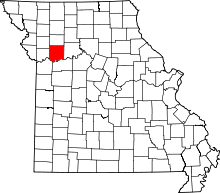 | |
| Villages | ||
| Townships | ||
| CDP | ||
| Other unincorporated communities | ||
| Ghost town | ||
| Footnotes | ‡This populated place also has portions in an adjacent county or counties | |