Helsa
| Helsa | ||
|---|---|---|
| ||
 Helsa Location of Helsa within Kassel district 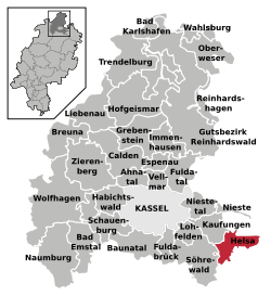 | ||
| Coordinates: 51°16′N 09°41′E / 51.267°N 9.683°ECoordinates: 51°16′N 09°41′E / 51.267°N 9.683°E | ||
| Country | Germany | |
| State | Hesse | |
| Admin. region | Kassel | |
| District | Kassel | |
| Government | ||
| • Mayor | Tilo Küthe | |
| Area | ||
| • Total | 25.77 km2 (9.95 sq mi) | |
| Elevation | 427 m (1,401 ft) | |
| Population (2017-12-31)[1] | ||
| • Total | 5,580 | |
| • Density | 220/km2 (560/sq mi) | |
| Time zone | CET/CEST (UTC+1/+2) | |
| Postal codes | 34298 | |
| Dialling codes |
05605 (Helsa), 05602 (Eschenstruth, St. Ottilien), 05604 (Wickenrode) | |
| Vehicle registration | KS | |
| Website | www.gemeinde-helsa.de | |

Helsa is a municipality and village in the district of Kassel, in Hesse, Germany. The municipality is situated in the Losse valley amongst the hills of the Kaufunger Wald, approx. 15 km east of Kassel.
Division of the municipality
The municipality consists of the villages, Eschenstruth (including Settlement Waldhof), Helsa, St. Ottilien and Wickenrode.
References
- ↑ "Bevölkerung der hessischen Gemeinden". Hessisches Statistisches Landesamt (in German). September 2018.
External links
- Official site (in German)
Towns and municipalities in Kassel district | ||
|---|---|---|
This article is issued from
Wikipedia.
The text is licensed under Creative Commons - Attribution - Sharealike.
Additional terms may apply for the media files.