Hearst, California
| Hearst | |
|---|---|
| Unincorporated community | |
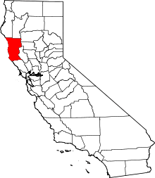
 Hearst Location in California  Hearst Hearst (the US) | |
| Coordinates: 39°29′30″N 123°12′53″W / 39.49167°N 123.21472°WCoordinates: 39°29′30″N 123°12′53″W / 39.49167°N 123.21472°W | |
| Country | United States |
| State | California |
| County | Mendocino County |
| Elevation[1] | 1,378 ft (420 m) |
Hearst (formerly, Travelers Home)[2] is an unincorporated community in Mendocino County, California.[1] It is located 13 miles (21 km) north-northwest of Potter Valley,[2] at an elevation of 1378 feet (420 m).[1]
Hearst is a small farming unincorporated community near Willits.[3] The area consists of large farming and ranch estates. There are also many landowners operating hospitality services on portions of their lands for camping geared towards campers, hunters, fishers, trekkers, and outdoorsmen. It is also known as Emandal or Emandal Resort after Hearst's largest cabin resort and farm. It is located at Latitude: 39.49333 : Longitude: -123.18083.[4]
One mile west was the Kinsner Soda Spring, which formerly produced and sold drinking water.[2]
A post office operated at Hearst from 1891 to 1953, having moved in 1898.[2] The name honors Senator George Hearst.[2]
References
- 1 2 3 U.S. Geological Survey Geographic Names Information System: Hearst, California
- 1 2 3 4 5 Durham, David L. (1998). California's Geographic Names: A Gazetteer of Historic and Modern Names of the State. Clovis, Calif.: Word Dancer Press. p. 75. ISBN 1-884995-14-4.
- ↑ City Data, Mendocino County profile, communities outside city limits list, accessed August 6, 2008
- ↑ City Data, access date August 6, 2008