Haynesville, Texas
| Haynesville | |
|---|---|
| Unincorporated community | |
 Haynesville Location within the state of Texas  Haynesville Haynesville (the US) | |
| Coordinates: 34°5′29″N 98°54′57″W / 34.09139°N 98.91583°WCoordinates: 34°5′29″N 98°54′57″W / 34.09139°N 98.91583°W | |
| Country | United States |
| State | Texas |
| County | Wichita |
| Elevation | 1,132 ft (345 m) |
| Population (2000) | |
| • Total | 60 |
| Time zone | UTC-6 (Central (CST)) |
| • Summer (DST) | UTC-5 (CDT) |
Haynesville (also known as Punkin Center) is an unincorporated community in Wichita County, Texas, United States. It has an estimated population of 60.
Haynesville is part of the Wichita Falls, Texas Metropolitan Statistical Area.
Geography
Haynesville is located at the intersection of State Highways 25 and 240, five miles north of Electra in northwestern Wichita County. The community's elevation is 1,132 feet above sea level.
History
The community was established in 1890 and originally named punkin center but later renamed after Henry Haynes, a county commissioner and local farmer. During most of the twentieth century, Haynesville's population ranged between approximately 60 and 100 residents.
Education
The Electra Independent School District serves the community of Haynesville.
External links
- Haynesville, Texas from the Handbook of Texas Online
- U.S. Geological Survey Geographic Names Information System: Haynesville
Municipalities and communities of Wichita County, Texas, United States | ||
|---|---|---|
| Cities | 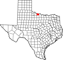 | |
| Town | ||
| Unincorporated communities | ||