Haverstock
| Haverstock Ward | |
|---|---|
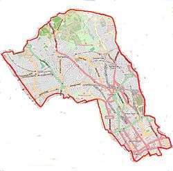
 Haverstock Ward Haverstock Ward shown within Greater London | |
| Population | 12,364 (2011 Census)[1] |
| OS grid reference | TQ273845 |
| London borough | |
| Ceremonial county | Greater London |
| Region | |
| Country | England |
| Sovereign state | United Kingdom |
| Post town | LONDON |
| Postcode district | NW3, NW5 |
| Police | Metropolitan |
| Fire | London |
| Ambulance | London |
| EU Parliament | London |
| UK Parliament | |
| London Assembly | |
Haverstock is an electoral ward in the London Borough of Camden: specifically the east of Belsize Park, north of Chalk Farm and west of Kentish Town. It is centred on Queens Crescent and Malden Road. Gospel Oak is to the north, Camden Town to the south.
Built environment
The Queen's Crescent NW5 area to the east of the hill is home to Queen's Crescent Market. If divided into nine equal sections the north-east to south-east third has most of the high density council housing centred on sports facilities at the 5-acre (2.0 ha) Talacre Gardens which adjoins Kentish Town West railway station[2] In the west a notable estate of partial social blocks is the Maitland Park Estate, Maitland Park Villas. Grand, classical architecture long roads are from west to east: Eton Road, Adelaide Road, Prince of Wales Road, Parkhill Road, Maitland Park Road, Queens Crescent and the east of Marsden Street and Malden Road.
Nearby open spaces and hills
Primrose Hill and Hampstead Heath are within 500 metres (of the south-west and north edges) of the ward.
Haverstock Hill, Rosslyn Hill, and Heath Street, Hampstead constitute a 2.8 km rise of 99 m, with an average gradient of 3.5% (maximum 8.5%).[3]
Cultural groups, entertainment and retail
The area is ethnically and socially diverse, and the marketplace and surrounding area is well known for its African, Jamaican, South American and Eastern European culture, well reflected in the ethnic food stalls and clothes shops in the area.
The top of Queens Crescent is a diverse 20 mph street and part-time market lined with about 30 shops/salons including a modern library, post office, two pharmacies, the Sir Robert Peel and specialist grocery shops selling a broad mixture of convenience and exotic foods. These are supplemented with corner cafés and hot food takeaways.
On this street Queen's Crescent Street Market has served the area and Gospel Oak for over 100 years and now frequently hosts farmers' markets and guest traders from across the UK.[4] The marketplace and surrounding area is well known for its African, Jamaican, South American and Eastern European culture.
Neighbouring streets of Kentish Town Road, east, and Chalk Farm Road, south-east are focussed on rows of bars, pubs, clubs and restaurants.
- Music and performance
The Barfly club, which launched many artists of the Britpop era, and the Roundhouse venue are in Chalk Farm Road, where among other bar-nightclubs on the road including The Enterprise Bar has two extra floors for gigs and weekend DJs; it culminates in Camden Market and facing restaurants/nightlife venues.
Demography
In the labour market, its claimant count for unemployment is the same as nationally, as at March 2018: 2.1%. This compares to a borough-wide average of 1.7%.[5]
Transport
In the ward:
- Kentish Town West — in the east
- Chalk Farm — in the south[n 1]
Beyond the north-west border[n 2]:
Famous residents
- Lindsay Duncan, actress
- Baroness Helena Kennedy, barrister and broadcaster
- Denis Lawson, actor
- Dame Ann Leslie, Daily Mail journalist and writer
- Hilton McRae, actor
- Billie Piper, actress and singer
- Leonard Whiting, actor
- Zeinab Badawi, BBC News Presenter has a home in the Haverstock Hill area.
Haverstock School includes former leader of the Labour Party Ed Miliband and former Members of Parliament David Miliband and Oona King amongst its alumni and alumna.
Politics
Haverstock is represented by three councillors on the London Borough of Camden, and forms part of the Holborn and St. Pancras constituency. The constituency had previously been a staunch Labour seat, but by 2010 had become marginal between Labour and the Liberal Democrats.
Since 2015 Keir Starmer of the Labour Party has been the MP for Holborn and St. Pancras. In 2013 the local councillors were Liberal Democrats Rahel Bokth, Jill Fraser and Matt Sanders.[6]
References
- References
- ↑ https://www.nomisweb.co.uk/query/asv2htm.aspx
- ↑ Protect Talacre Gardens Youtube video regarding Talacre Gardens.
- ↑ "Haverstock Hill + Rosslyn Hill + Heath St". VeloViewer. 2012. Retrieved 6 August 2013.
- ↑ Queen's Crescent Market, Camden Council
- ↑ https://www.nomisweb.co.uk/reports/lmp/ward2011/1140857853/report.aspx?town=Haverstock
- ↑ Haverstock Ward Councillors, London Borough of Camden
- Notes
- ↑ Chalk Farm was once served by Haverstock Hill railway station which closed in 1916.
- ↑ borders as they stand in 2018