Hatun P'ukru
| Hatun P'ukru | |
|---|---|
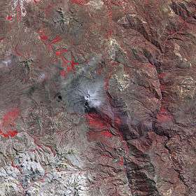 The Ubinas volcano and Hatun P'ukru southeast of it (lower right) as seen from above (NASA, 2006) | |
| Highest point | |
| Elevation | 5,153 m (16,906 ft) [1] |
| Coordinates | 16°31′04″S 70°45′29″W / 16.51778°S 70.75806°WCoordinates: 16°31′04″S 70°45′29″W / 16.51778°S 70.75806°W |
| Geography | |
 Hatun P'ukru Peru | |
| Location | Peru, Moquegua Region |
| Parent range | Andes |
Hatun P'ukru (Quechua hatun big, p'ukru hole, pit, gap in a surface,[2] "big hole", hispanicized spelling Jatun Pucro) is a mountain in the Andes of southern Peru, about 5,153-metre (16,906 ft) high. It is situated in the Moquegua Region, General Sánchez Cerro Province, on the border of the districts of Chojata and Matalaque.[1][3]
References
- 1 2 "Cerro Jatun Pucro". IGN, Peru. Archived from the original on February 3, 2015. Retrieved February 3, 2015.
- ↑ Teofilo Laime Ajacopa, Diccionario Bilingüe Iskay simipi yuyayk'ancha, La Paz, 2007 (Quechua-Spanish dictionary)
- ↑ escale.minedu.gob.pe - UGEL map of the General Sánchez Cerro Province (Moquegua Region)
This article is issued from
Wikipedia.
The text is licensed under Creative Commons - Attribution - Sharealike.
Additional terms may apply for the media files.