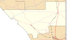
Hatherleigh, South Australia
| Hatherleigh South Australia | |||||||||||||||
|---|---|---|---|---|---|---|---|---|---|---|---|---|---|---|---|
 Hatherleigh | |||||||||||||||
| Coordinates | 37°29′32″S 140°16′23″E / 37.492175°S 140.273069°ECoordinates: 37°29′32″S 140°16′23″E / 37.492175°S 140.273069°E[1] | ||||||||||||||
| Population | 131 (2016 census)[2] | ||||||||||||||
| Established |
20 November 1879 (town) 23 February 1995 (locality)[1] | ||||||||||||||
| Postcode(s) | 5280 | ||||||||||||||
| Time zone | ACST (UTC+9:30) | ||||||||||||||
| • Summer (DST) | ACST (UTC+10:30) | ||||||||||||||
| Location | 15 km (9 mi) N of Millicent | ||||||||||||||
| LGA(s) | Wattle Range Council | ||||||||||||||
| State electorate(s) | Mackillop | ||||||||||||||
| Federal Division(s) | Barker | ||||||||||||||
| |||||||||||||||
Hatherleigh is a locality in the Australian state of South Australia in the state's Limestone Coast region.[1] It is located on the Princes Highway north of Millicent.
References
- 1 2 3 "Search results for 'Hatherleigh, LOCB' with the following datasets being selected - 'Suburbs and Localities', 'Government Towns', 'Counties', 'Hundreds', 'Local Government Areas', 'SA Government Regions', 'Land Development Plan Zone Categories' and 'Gazetteer'". Location SA Map Viewer. Government of South Australia. Retrieved 22 February 2018.
- ↑ Australian Bureau of Statistics (27 June 2017). "Hatherleigh". 2016 Census QuickStats. Retrieved 22 February 2018.

This article is issued from
Wikipedia.
The text is licensed under Creative Commons - Attribution - Sharealike.
Additional terms may apply for the media files.