Hasbergen
| Hasbergen | ||
|---|---|---|
| ||
 Hasbergen Location of Hasbergen within Osnabrück district 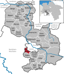  | ||
| Coordinates: 52°13′N 07°55′E / 52.217°N 7.917°ECoordinates: 52°13′N 07°55′E / 52.217°N 7.917°E | ||
| Country | Germany | |
| State | Lower Saxony | |
| District | Osnabrück | |
| Government | ||
| • Mayor | Frank Stiller (SPD) | |
| Area | ||
| • Total | 21.37 km2 (8.25 sq mi) | |
| Elevation | 62-228 m (−686 ft) | |
| Population (2017-12-31)[1] | ||
| • Total | 10,944 | |
| • Density | 510/km2 (1,300/sq mi) | |
| Time zone | CET/CEST (UTC+1/+2) | |
| Postal codes | 49205 | |
| Dialling codes | 05405 | |
| Vehicle registration | OS | |
| Website | www.hasbergen.de | |

Hasbergen is a municipality in the district of Osnabrück, in Lower Saxony, Germany. It is situated in the Teutoburg Forest, approx. 7 km west of Osnabrück.
The municipality lies partly in the Hüggel hills, that belongs to the Teutoburg Forest Protected Area. The hills range from 62 to 228 metres above sea level (NN). In Hasbergen is the 108 metre high Rote Berg.
References
This article is issued from
Wikipedia.
The text is licensed under Creative Commons - Attribution - Sharealike.
Additional terms may apply for the media files.