Harts Ground
| Harts Grounds | |
|---|---|
 Harts Ground | |
 Harts Grounds Harts Grounds shown within Lincolnshire | |
| OS grid reference | TF208532 |
| • London | 100 mi (160 km) S |
| Civil parish | |
| District | |
| Shire county | |
| Region | |
| Country | England |
| Sovereign state | United Kingdom |
| Post town | Boston |
| Postcode district | LN4 |
| Police | Lincolnshire |
| Fire | Lincolnshire |
| Ambulance | East Midlands |
| EU Parliament | East Midlands |
| UK Parliament | |
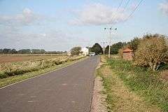
Harts Ground or Harts Grounds is a hamlet in Holland Fen with Brothertoft parish, and the Borough of Boston, Lincolnshire, England. It is situated 9 miles (14 km) north-west from the town of Boston.[1]
Harts Ground was formerly an extra-parochial area, prone to flooding prior to the drainage of Holland Fen in 1767.[2] It was a civil parish, from 1858 to 1935 when it was reduced to enlarge Dogdyke.[3] It was, and remains today, an area of isolated farms.[4]
Harts Grounds Farmhouse dates to the late 18th century, built in rendered brick with a pantile roof, and is a Grade II listed building.[5][6]
References
- ↑ Boston: Tattershall, Billinghay & Heckington (Map) (A1 ed.). 1:25 000. OS Explorer. Ordnance survey of Great Britain. 13 November 2006. § 261. ISBN 9780319238172.
- ↑ Pishey Thompson (1856). The History and Antiquities of Boston. Retrieved 6 May 2011.
- ↑ "Vision of Britain". University of Portsmouth. Retrieved 6 May 2011.
- ↑ "Lincs to the Past". Lincolnshire Archives/English Heritage. Retrieved 6 May 2011.
- ↑ "Lincs to the Past". Lincolnshire Archives/English Heritage. Retrieved 6 May 2011.
- ↑ "Harts Grounds Farmhouse (Tf 202 516), Holland Fen with Brothertoft". British Listed Buildings. Retrieved 6 May 2011.
External links

England Portal | |
| Unitary authorities | |
| Boroughs or districts | |
| Major settlements |
|
| Topics | |
This article is issued from
Wikipedia.
The text is licensed under Creative Commons - Attribution - Sharealike.
Additional terms may apply for the media files.