Hart, North Dakota
| Hart, North Dakota | |
|---|---|
| Unorganized territory | |
 Location of Hart | |
| Coordinates: 46°09′23″N 103°34′50″W / 46.15639°N 103.58056°WCoordinates: 46°09′23″N 103°34′50″W / 46.15639°N 103.58056°W | |
| Country | United States |
| State | North Dakota |
| County | Bowman |
| Population (2010) | |
| • Total | 25 |
| Time zone | UTC-7 (Mountain (MST)) |
| • Summer (DST) | UTC-6 (MDT) |
| Area code(s) | 701 |
Hart is an unorganized territory in Bowman County in the U.S. state of North Dakota. As of the 2010 census, its population was 25.[1]
References
- ↑ "Geographic Identifiers: 2010 Demographic Profile Data (G001): Hart UT, Bowman County, North Dakota". U.S. Census Bureau, American Factfinder. Retrieved Aug 13, 2016.
Municipalities and communities of Bowman County, North Dakota, United States | ||
|---|---|---|
| Cities | 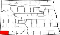 | |
| Townships | ||
| Unorganized territories | ||
| Unincorporated communities |
| |
This article is issued from
Wikipedia.
The text is licensed under Creative Commons - Attribution - Sharealike.
Additional terms may apply for the media files.