Hardyville, Virginia
| Hardyville, Virginia | |
|---|---|
| Unincorporated community | |
 Hardyville, Virginia  Hardyville, Virginia | |
| Coordinates: 37°33′24″N 76°22′19″W / 37.55667°N 76.37194°WCoordinates: 37°33′24″N 76°22′19″W / 37.55667°N 76.37194°W | |
| Country | United States |
| State | Virginia |
| County | Middlesex |
| Elevation | 36 ft (11 m) |
| Time zone | UTC-5 (Eastern (EST)) |
| • Summer (DST) | UTC-4 (EDT) |
| ZIP code | 23070 |
| Area code(s) | 804 |
| GNIS feature ID | 1467746[1] |
Hardyville is an unincorporated community in Middlesex County, Virginia, United States. Hardyville is located on Virginia State Route 33 1.7 miles (2.7 km) west of Deltaville. Hardyville has a post office with ZIP code 23070, which opened on October 14, 1922.[2][3]
References
- ↑ "Hardyville". Geographic Names Information System. United States Geological Survey.
- ↑ United States Postal Service (2012). "USPS - Look Up a ZIP Code". Retrieved 2012-02-15.
- ↑ "Postmaster Finder - Post Offices by ZIP Code". United States Postal Service. Retrieved August 21, 2012.
Municipalities and communities of Middlesex County, Virginia, United States | ||
|---|---|---|
| Town | 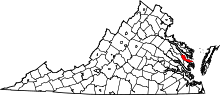 | |
| CDPs | ||
| Unincorporated communities | ||
| Footnotes | ‡This populated place also has portions in an adjacent county or counties | |
This article is issued from
Wikipedia.
The text is licensed under Creative Commons - Attribution - Sharealike.
Additional terms may apply for the media files.