Hans Meyer Range
| Hans Meyer Range | |
|---|---|
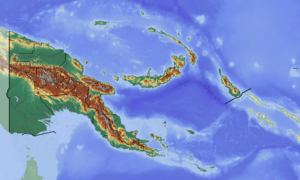 Location of the Hans Meyer Range in Papua New Guinea | |
| Highest point | |
| Peak | Mount Taron |
| Elevation | 2,379 m (7,805 ft) |
| Geography | |
| Country | Papua New Guinea |
| State/Province | New Ireland Province |
| Range coordinates | 4°24′S 152°58′E / 4.400°S 152.967°ECoordinates: 4°24′S 152°58′E / 4.400°S 152.967°E |
| Geology | |
| Type of rock | Limestone and volcanic rock |
The Hans Meyer Range is a mountain range in the southern part of New Ireland, Papua New Guinea. This range was named after German geographer Hans Meyer (1858–1929).[1]
2,379 m high Mount Taron, the highest point of the range, is also the highest point of New Ireland.
Geography
Together with the Verron Range and the Lelet Plateau, it is one of the main mountainous features of New Ireland.[2] It is located in the broader southern part of the island and runs roughly in a north-south-direction, parallel to the Verron Range. The Weitin valley divides the two ranges, Hans Meyer on the east and Verron on the west.
As other mountain ranges in Papua New Guinea it is home to many rare species of fauna and flora and is highly biodiverse and covered in thick rainforest. This range is part of the New Britain-New Ireland lowland rain forest terrestrial ecoregion.[3]
References
- ↑ Heiner Wesemann, Papua-Neuguinea, Kultur - Landschaft. DuMont Dokumente. DuMont Buchverlag, Köln 1985, ISBN 3-7701-1322-5, p. 298
- ↑ NI mountains tell a tale Archived 2012-04-05 at the Wayback Machine.
- ↑ "New Britain-New Ireland lowland rain forests". Terrestrial Ecoregions. World Wildlife Fund.
External links