Hang Hau station
Hang Hau 坑口 | |||||||||||||||||||||||||||||||||||||||||||||||||||||||||||||||||||||||||||||||||||||||||||||||||||||||||
|---|---|---|---|---|---|---|---|---|---|---|---|---|---|---|---|---|---|---|---|---|---|---|---|---|---|---|---|---|---|---|---|---|---|---|---|---|---|---|---|---|---|---|---|---|---|---|---|---|---|---|---|---|---|---|---|---|---|---|---|---|---|---|---|---|---|---|---|---|---|---|---|---|---|---|---|---|---|---|---|---|---|---|---|---|---|---|---|---|---|---|---|---|---|---|---|---|---|---|---|---|---|---|---|---|---|
| MTR rapid transit station | |||||||||||||||||||||||||||||||||||||||||||||||||||||||||||||||||||||||||||||||||||||||||||||||||||||||||
 Platform 2 | |||||||||||||||||||||||||||||||||||||||||||||||||||||||||||||||||||||||||||||||||||||||||||||||||||||||||
| Chinese name | |||||||||||||||||||||||||||||||||||||||||||||||||||||||||||||||||||||||||||||||||||||||||||||||||||||||||
| Chinese | 坑口 | ||||||||||||||||||||||||||||||||||||||||||||||||||||||||||||||||||||||||||||||||||||||||||||||||||||||||
| Cantonese Yale | Hāangháu | ||||||||||||||||||||||||||||||||||||||||||||||||||||||||||||||||||||||||||||||||||||||||||||||||||||||||
| Literal meaning | Pit Mouth | ||||||||||||||||||||||||||||||||||||||||||||||||||||||||||||||||||||||||||||||||||||||||||||||||||||||||
| |||||||||||||||||||||||||||||||||||||||||||||||||||||||||||||||||||||||||||||||||||||||||||||||||||||||||
| General information | |||||||||||||||||||||||||||||||||||||||||||||||||||||||||||||||||||||||||||||||||||||||||||||||||||||||||
| Location |
15 Pui Shing Road, Hang Hau, Tseung Kwan O Sai Kung District, Hong Kong | ||||||||||||||||||||||||||||||||||||||||||||||||||||||||||||||||||||||||||||||||||||||||||||||||||||||||
| Coordinates | 22°18′56″N 114°15′52″E / 22.3156°N 114.2644°ECoordinates: 22°18′56″N 114°15′52″E / 22.3156°N 114.2644°E | ||||||||||||||||||||||||||||||||||||||||||||||||||||||||||||||||||||||||||||||||||||||||||||||||||||||||
| Operated by | MTR Corporation | ||||||||||||||||||||||||||||||||||||||||||||||||||||||||||||||||||||||||||||||||||||||||||||||||||||||||
| Line(s) | |||||||||||||||||||||||||||||||||||||||||||||||||||||||||||||||||||||||||||||||||||||||||||||||||||||||||
| Platforms | 2 (side platforms) | ||||||||||||||||||||||||||||||||||||||||||||||||||||||||||||||||||||||||||||||||||||||||||||||||||||||||
| Connections | Bus, Minibus | ||||||||||||||||||||||||||||||||||||||||||||||||||||||||||||||||||||||||||||||||||||||||||||||||||||||||
| Construction | |||||||||||||||||||||||||||||||||||||||||||||||||||||||||||||||||||||||||||||||||||||||||||||||||||||||||
| Structure type | Underground | ||||||||||||||||||||||||||||||||||||||||||||||||||||||||||||||||||||||||||||||||||||||||||||||||||||||||
| Platform levels | 1 | ||||||||||||||||||||||||||||||||||||||||||||||||||||||||||||||||||||||||||||||||||||||||||||||||||||||||
| Disabled access | Yes | ||||||||||||||||||||||||||||||||||||||||||||||||||||||||||||||||||||||||||||||||||||||||||||||||||||||||
| Other information | |||||||||||||||||||||||||||||||||||||||||||||||||||||||||||||||||||||||||||||||||||||||||||||||||||||||||
| Station code | HAH | ||||||||||||||||||||||||||||||||||||||||||||||||||||||||||||||||||||||||||||||||||||||||||||||||||||||||
| History | |||||||||||||||||||||||||||||||||||||||||||||||||||||||||||||||||||||||||||||||||||||||||||||||||||||||||
| Opened |
| ||||||||||||||||||||||||||||||||||||||||||||||||||||||||||||||||||||||||||||||||||||||||||||||||||||||||
| Services | |||||||||||||||||||||||||||||||||||||||||||||||||||||||||||||||||||||||||||||||||||||||||||||||||||||||||
|
| |||||||||||||||||||||||||||||||||||||||||||||||||||||||||||||||||||||||||||||||||||||||||||||||||||||||||
| |||||||||||||||||||||||||||||||||||||||||||||||||||||||||||||||||||||||||||||||||||||||||||||||||||||||||
| Location | |||||||||||||||||||||||||||||||||||||||||||||||||||||||||||||||||||||||||||||||||||||||||||||||||||||||||
|
Hang Hau Location within the MTR system | |||||||||||||||||||||||||||||||||||||||||||||||||||||||||||||||||||||||||||||||||||||||||||||||||||||||||
Hang Hau (Chinese: 坑口) is an MTR station located at 15 Pui Shing Road, Hang Hau, Tseung Kwan O. It is on the Tseung Kwan O Line, located between Po Lam and Tseung Kwan O stations. This station is surrounded by an extensive network of mid-sized shopping arcades linked by footbridges and it is in the vicinity of many housing complexes. Due to its proximity and the availability of feeder transport to Sai Kung Town, Clear Water Bay and The Hong Kong University of Science and Technology, it is one of the busiest stations on the Tseung Kwan O line.
Station layout
| - | Residential area Shopping malls |
Residence Oasis, The Lane |
| Footbridge to Nan Fung Plaza, East Point City, Maritime Bay | ||
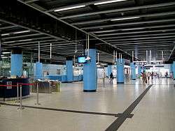
| G | Concourse | Exits, transport interchange |
| Customer service, MTRshops, vending machines | ||
| Automatic teller machines, Octopus promotion machine | ||
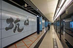
| L1 Platforms |
Side platform, doors will open on the left | |
| Platform 1 | Tseung Kwan O line towards Po Lam (Terminus) → | |
| Platform 2 | ← Tseung Kwan O line towards North Point (Tseung Kwan O) | |
| Side platform, doors will open on the left | ||
The station has two tracks and two side platforms.[1]
Entrances/exits
- A1: Residence Oasis
- A2: On Ning Garden

- B1: The Lane
- B2: Transport Interchange
Transport connections
A Transport Interchange is found by exiting through Exit B1 or A1.
Minibus routes
[2] To Hang Hau Village:
- 11A
To Sai Kung Town:
- 101M
To Hong Kong University of Science and Technology:
- 11M
To Oscar by the Sea (via Tseung Kwan O Hospital and Fu Ning Gardens):
- 109M
Bus routes
[2] To Diamond Hill Station via Hong Kong University of Science and Technology
- 91M
- 98A
To Mei Foo via Kowloon City, Mong Kok and Shum Shui Po
- 98C
- 98D
To Tsuen Wan West Station via Wong Tai Sin, Kwai Chung
- 290, 290A
To Hong Sing Garden via Sheung Tak Estate and Po Lam
- 296M
To Tseung Kwan O Industrial Estate (via LOHAS Park)
- 298E (Circular)
To Hung Hom Ferry via To Kwa Wan
- 297
To Fo Tan via Sha Tin
- 798
References
- ↑ "Hang Hau Station layout" (PDF). MTR Corporation. Retrieved 30 October 2016.
- 1 2 "Hang Hau Station street map" (PDF). MTR Corporation. Retrieved 30 October 2016.
| Wikimedia Commons has media related to Hang Hau Station. |