Hancock Pass
| Hancock Pass | |
|---|---|
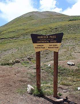 The sign at the top of the pass. | |
| Elevation | 12,208 ft (3,721 m)[1] |
| Location | Chaffee and Gunnison counties, Colorado. |
| Range | Rocky Mountains |
| Coordinates | 38°37′15″N 106°22′27″W / 38.62083°N 106.37417°WCoordinates: 38°37′15″N 106°22′27″W / 38.62083°N 106.37417°W |
| Topo map | Garfield |
Hancock Pass, elevation 12,208 ft (3,721 m), is a high mountain pass on the Continental Divide in western Colorado. The pass is on the border between Chaffee and Gunnison counties and between the Gunnison and San Isabel national forests.
The road over the pass is of moderate difficulty and is very rocky and slow going. [2]
References
- ↑ "Hancock Pass". Geographic Names Information System. United States Geological Survey. Retrieved 2014-08-24.
- ↑ Trip Advisor. Hancock Pass/ Alpine Tunnel 4x4 Road. Viewed 2014-08-24
This article is issued from
Wikipedia.
The text is licensed under Creative Commons - Attribution - Sharealike.
Additional terms may apply for the media files.