Hanapēpē River
| Hanapēpē River | |
| Country | United States |
|---|---|
| State | Hawaii |
| Source | Confluence of the Kō'ula River and Manuahi stream |
| Mouth | Pacific Ocean |
| - location | Hanapepe, Hawaii, Eleele, Hawaii |
| - elevation | 0 m (0 ft) |
| - coordinates | 21°54′15″N 159°35′29″W / 21.904223°N 159.591522°WCoordinates: 21°54′15″N 159°35′29″W / 21.904223°N 159.591522°W |
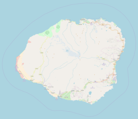  | |
The Hanapepe River is a river on the Hawaiian island of Kauai. It begins at the confluence of the Kō'ula River with the Manuahi Stream and flows generally south for 8.5 miles to its mouth at Hanapepe and Eleele in the Pacific Ocean.[1] The watershed covers an area of 27.7 square miles, draining roughly a twentieth of the island.[2] The name Hanapepe translates to "crushed bay."
References
- ↑ http://www.hawaiiwatershedatlas.com/watersheds/kauai/23007.pdf
- ↑ Hanapepe River. "Hanapepe River Topo Map, Kauai County HI (Hanapepe Area)". Topozone.com. Retrieved 2018-01-22.
This article is issued from
Wikipedia.
The text is licensed under Creative Commons - Attribution - Sharealike.
Additional terms may apply for the media files.