Hamta Pass
| Hamta Pass हम्ता पास/ दर्रा | |
|---|---|
| Mountain Pass | |
| Nickname(s): Hamta | |
 Hamta Pass  Hamta Pass | |
| Coordinates: 31°57′47″N 77°27′12″E / 31.963024°N 77.453296°ECoordinates: 31°57′47″N 77°27′12″E / 31.963024°N 77.453296°E | |
| Country | India |
| State | Himachal Pradesh |
| District | Kullu |
| Elevation | 4,270 m (14,010 ft) |
| Languages | |
| • Official | Hindi |
| • Regional | Kulvi |
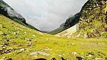
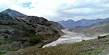
Hamta Pass lies at an altitude of 4270 m (14039 ft) on the Pir Panjal range in the Himalayas. It is a small corridor between Lahaul's Chandra Valley and Kullu valley of Himachal Pradesh, India. The nomenclature of the trek was derived from Hamta Village, located below Sethan village, as part of the trek route. This pass is frequently used by shepherds of lower Himalayan region, seeking for high altitude grassland in the dry cold desert of Lahaul during summer time. Numbers of wild flowers and herbs grow at the altitude between 3000 to 3800 m. Vertical rock walls, water falls, hanging glaciers, pinewoods, rhododendron forests, open meadows, tiny lakes and peaks rising above 6000 m are the main characteristics of this trek. The base camp for the trek is Jobra. This trek, deemed to have dramatic changes in landscape by premier trek organisers, usually needs experienced guides to help navigate across glaciers, fast-flowing rivers and a challenging terrain. Beyond Hamta pass, trekkers can choose to extend their trek towards the beautiful Chandrataal lake.[1] [2] For Hamta Pass Trek, first you will have to Reach Manali and then drive till Jobra and trek further with assistance. Camp stops are naturally done at Chika, Balu ka gera, Chatru etc. [3]
Standard Trek Itinerary
Day 1 (Manali to Jobri campsite, 30-mins): Start the trek from Jobri, a short drive from Manali. From where the road ends, the campsite for the day is only a 30-min walk through mixed forests of pine, maple and birch trees.
Day 2 (Jobra to Jwara campsite, 5-6 hours): The trail from Jobra to Jwara is continually intercepted by the Rani river, with a resting point in between at Chika. Chika can easily be spotted by a couple of waterfalls. To stay on track, it is best to continually head right but staying on the left bank of the Rani river.
Day 3 (Jwara to Balu Ka Ghera campsite, 4-5 hours): Keep hiking along the Rani river to stay on-track. The preferred resting point for trekkers would be Chota Balu Ka Ghera, easily identified by a sudden flat terrain. Balu Ka Ghera, your campsite for the day is on a bed of sand, an incredible campsite with Hamta Pass that can be seen at a distance.
Day 4 (Balu Ka Ghera to Shea Goru campsite via Hamta Pass, 9 hours): The pass crossing day has three parts - the ascent from the Kullu Valley, the ridge that is Hamta Pass and then the descent to the Lahaul valley, ending at Shea Goru.
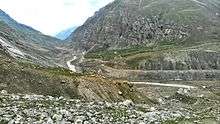
Day 5 (Shea Goru to Chhatru, 4-4.5 hours): The trek from Shea Goru to Chhatru will be comprised by 2-3 large glacial flows onto the Chandra river. The camping site at Chhatru is gorgeous, boasting of views of different mountain ranges.[4]
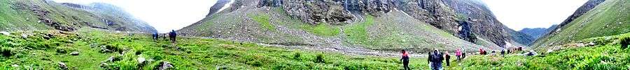
Panorama View (3777m)

References