Hamperokken
| Hamperokken | |
|---|---|
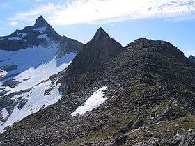 Hamperokken peak to the left. | |
| Highest point | |
| Elevation | 1,404 m (4,606 ft) |
| Prominence | 1,396 m (4,580 ft) |
| Isolation | 19 kilometres (12 mi) |
| Listing | 6th most prominent peak in Norway |
| Coordinates | 69°33′35″N 19°21′32″E / 69.5598°N 19.3588°ECoordinates: 69°33′35″N 19°21′32″E / 69.5598°N 19.3588°E [1] |
| Geography | |
 Hamperokken Location of the mountain  Hamperokken Hamperokken (Norway) | |
| Location | Troms, Norway |
| Parent range | Tromsø |
| Topo map | 1534 II Ullsfjord |
| Climbing | |
| Easiest route | Hike |
Hamperokken (Northern Sami: Gáranasčohkka) is a mountain in Tromsø Municipality in Troms county, Norway.[2] At 1,404-metre (4,606 ft) tall, it is the highest mountain peak on the mainland peninsula west of the Ullsfjorden. Hamperokken has the 6th most prominent peak in Norway with a prominence of 1,396 metres (4,580 ft). The mountain sits about 6.7 kilometres (4.2 mi) west of the village of Fagernes and the European route E8 and it is also about 20 kilometres (12 mi) southeast of the city of Tromsø.
References
- ↑ "Hamperokken, Tromsø (Troms)" (in Norwegian). yr.no. Retrieved 2018-08-12.
- ↑ "Hamperokken" (in Norwegian). yr.no. Retrieved 2010-04-12.
This article is issued from
Wikipedia.
The text is licensed under Creative Commons - Attribution - Sharealike.
Additional terms may apply for the media files.