Hönne
| Hönne | |
|---|---|
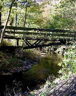 The Hönne in Balve | |
| Country | Germany |
| Physical characteristics | |
| Main source |
Neuenrade 437 m (1,434 ft) |
| River mouth |
Ruhr 51°28′06″N 7°45′58″E / 51.4683°N 7.7661°ECoordinates: 51°28′06″N 7°45′58″E / 51.4683°N 7.7661°E |
| Length | 33.4 km (20.8 mi) [1] |
| Basin features | |
| Progression | Ruhr→ Rhine→ North Sea |
| Basin size | 262 km2 (101 sq mi) [1] |
The Hönne is a left tributary river to the Ruhr, flowing through the northern Sauerland hills in North Rhine-Westphalia, Germany. The spring of the Hönne is located in the west of Neuenrade at 437m above sea level. After 33 km the river ends near the town of Fröndenberg. The total catchment area of the river is 262 km².[2]
Most notable is the narrow valley between Balve and Menden, where the Hönne has carved 60m deep into Devonian limestone. Several caves are located in the valley, of which the Balver Höhle and the Reckenhöhle are accessible for visitors. When the water level in the river is low, some parts of the valley fall dry as the water flows subterraneously through the Karst rocks. Several of the tributary brooks in that valley also flow subterraneously for some parts of their course.
Caves
Many caves were formed throughout the Hönne. The biggest culture cave in Europe is located in Balve. A cave with flowstone, the Reckenhöhle, is also nearby.
Some experts found signs of cannibalism in the caves (especially the Karhofhöhle) that date from 1000 to 700 BCE.[3]
References
- 1 2 Hydrographic Directory of the NRW State Office for Nature, the Environment and Consumer Protection (Gewässerverzeichnis des Landesamtes für Natur, Umwelt und Verbraucherschutz NRW 2010) (xls; 4.67 MB)
- ↑ Gewässerstrukturgüte in Nordrhein-Westfalen 2005, Page 52
- ↑ "Kannibalen in Westfalen?" Stefan Enste. Retrieved October 02, 2015.
Sources
- Dickhäuser, Oliver (2005). "Das Hönnetal". Der Schlüssel. 50 (2): 46–52.
| Wikimedia Commons has media related to Hönne. |