Hódmezővásárhely District
| Hódmezővásárhely District Hódmezővásárhelyi járás | ||
|---|---|---|
| Districts of Hungary | ||
| ||
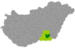 Hódmezővásárhely District within Hungary and Csongrád County. | ||
| Country |
| |
| County | Csongrád | |
| District seat | Hódmezővásárhely | |
| Area | ||
| • Total | 707.77 km2 (273.27 sq mi) | |
| Area rank | 3rd in Csongrád | |
| Population (2011 census) | ||
| • Total | 56,560 | |
| • Rank | 2nd in Csongrád | |
| • Density | 80/km2 (200/sq mi) | |

Hódmezővásárhely (Hungarian: Hódmezővásárhelyi járás) is a district in eastern part of Csongrád County. Hódmezővásárhely is also the name of the town where the district seat is found. The district is located in the Southern Great Plain Statistical Region.
Geography
Hódmezővásárhely District borders with Szentes District to the north, Orosháza District (Békés County) to the east, Makó District to the south, Szeged District and Kistelek District to the west. The number of the inhabited places in Hódmezővásárhely District is 4.
Municipalities
The district has 1 urban county, 1 town and 2 villages. (ordered by population, as of 1 January 2012)[1]
- Hódmezővásárhely (46,522) – district seat
- Mártély (1,359)
- Mindszent (6,685)
- Székkutas (2,336)
The bolded municipalities are cities.
Demographics
Religion in Hódmezővásárhely District (2011 census)
In 2011, it had a population of 56,560 and the population density was 80/km².
| Year | County population[2] | Change |
|---|---|---|
| 2011 | 56,560 | n/a |
Ethnicity
Besides the Hungarian majority, the main minorities are the Roma (approx. 600) and German (250).
Total population (2011 census): 56,560
Ethnic groups (2011 census):[3] Identified themselves: 50,015 persons:
- Hungarians: 48,444 (96.86%)
- Gypsies: 571 (1.41%)
- Others and indefinable: 1,000 (2.00%)
Approx. 6,500 persons in Hódmezővásárhely District did not declare their ethnic group at the 2011 census.
Religion
Religious adherence in the county according to 2011 census:[4]
- Catholic – 13,789 (Roman Catholic – 13,699; Greek Catholic – 88);
- Reformed – 8,059;
- Evangelical – 369;
- other religions – 1,277;
- Non-religious – 16,606;
- Atheism – 771;
- Undeclared – 15,689.
Gallery
 Hódmezővásárhely, the Peasant Paris
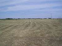 Plain near Mártély
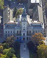 Town Hall in Hódmezővásárhely
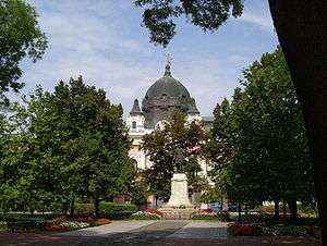 Park in Hódmezővásárhely
 Reformed Church in Hódmezővásárhely
See also
References
- ↑ A KSH 2012. évi helységnévkönyve
- ↑ népesség.com, "Hódmezővásárhelyi járás népessége"
- ↑ 4.1.6.1 A népesség nemzetiség szerint, 2011, (in Hungarian)
- ↑ 4.1.7.1 A népesség vallás, felekezet szerint, 2011, (in Hungarian)
External links
| City with county rights (1) |
| |
|---|---|---|
| Town (1) | ||
| Villages (2) | ||