Gurua
| Gurua | |
|---|---|
| Community development block | |
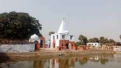 Gurua surya mandir | |
 Gurua Location in Bihar, India | |
| Coordinates: 24°40′07″N 84°46′20″E / 24.668643°N 84.772342°ECoordinates: 24°40′07″N 84°46′20″E / 24.668643°N 84.772342°E | |
| Country |
|
| State | Bihar |
| District | Gaya |
| CD block | Gurua |
| Time zone | UTC+5:30 (IST) |
| PIN | 824205(Gurua) |
| Telephone/STD code | +91631 |
| Vehicle registration | BR 02 |
| Lok Sabha constituency | Aurangabad |
| Vidhan Sabha constituency | Gurua |
| Website |
gaya |
Gurua is a community development block that forms an administrative division in Gaya district, Bihar state, India.
Geography
Gurua is located at 24°40′07″N 84°46′20″E / 24.668643°N 84.772342°E.[1]
Literacy
As per 2011 census, literacy in Dhanbad district was 72.52.Literacy in Bihar (for population over 7 years) was 60.41% in 2011. Literacy in India in 2011 was 74.04%.[2]
References
- ↑ "Gaya, India Page". fallingrain.com. Retrieved 23 December 2015.
- ↑ http://www.census2011.co.in/data/subdistrict/1498-gurua-gaya-bihar.html
This article is issued from
Wikipedia.
The text is licensed under Creative Commons - Attribution - Sharealike.
Additional terms may apply for the media files.