Gulfport–Biloxi International Airport
| Gulfport–Biloxi International Airport | |||||||||||||||
|---|---|---|---|---|---|---|---|---|---|---|---|---|---|---|---|
|
| |||||||||||||||
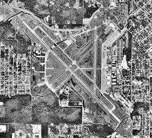 USGS 1992 orthophoto | |||||||||||||||
| Summary | |||||||||||||||
| Airport type | Public | ||||||||||||||
| Owner | Gulfport–Biloxi Regional Airport Authority | ||||||||||||||
| Serves | Gulfport–Biloxi metropolitan area | ||||||||||||||
| Location | Gulfport, Mississippi | ||||||||||||||
| Elevation AMSL | 28 ft / 9 m | ||||||||||||||
| Coordinates | 30°24′26″N 089°04′12″W / 30.40722°N 89.07000°WCoordinates: 30°24′26″N 089°04′12″W / 30.40722°N 89.07000°W | ||||||||||||||
| Website | www.FlyGPT.com | ||||||||||||||
| Map | |||||||||||||||
 GPT Location of airport in Mississippi / United States  GPT GPT (the US) | |||||||||||||||
| Runways | |||||||||||||||
| |||||||||||||||
| Statistics (2012) | |||||||||||||||
| |||||||||||||||
Gulfport–Biloxi International Airport (IATA: GPT[3], ICAO: KGPT, FAA LID: GPT) is a joint civil–military public-use airport three nautical miles (6 km) northeast of the central business district of Gulfport, a city in Harrison County, Mississippi, United States.[2] It is owned by the Gulfport–Biloxi Regional Airport Authority[2] and serves the Gulf Coast area.
This airport is included in the National Plan of Integrated Airport Systems for 2011–2015, which categorized it as a primary commercial service airport (more than 10,000 enplanements per year).[4] As per Federal Aviation Administration records, the airport had 487,907 passenger boardings (enplanements) in calendar year 2008,[5] 411,978 enplanements in 2009, and 325,437 emplacements in 2014.[6]
History
The airport was originally built in 1942 by the United States Army Air Forces as a training base for Air Corps Flying Training Command. Gulfport Army Airfield opened on July 7, and the Eastern Technical Training Command conducted technical training and basic training unit transferred to Third Air Force on March 31, 1944 with joint use by Technical Training Command for marine training of Emergency Rescue School (3d Air Rescue Group) at Keesler Army Airfield. With the end of the war and the drawdown of the military, Gulfport AAF was placed into reserve status on January 31, 1946.
Gulfport Field was declared excess by the Air Force and conveyed by the War Assets Administration to the City of Gulfport in 1949 for use as a civil airport. The city negotiated airline service contracts with Southern Airways and later National Airlines to provide passenger and cargo service beginning in the early 1950s.
Due to the large expansion of the United States Air Force as a result of the Cold War, a new lease was obtained for military use of the airport and Gulfport Air Force Base was opened as a joint-use civil–military facility. Gulfport AFB was closed as an active Air Force installation and its military facilities were transferred to the Mississippi Air National Guard, with the airport remaining a joint-use airport and Air National Guard base. Although no military aircraft are permanently assigned, the base serves as the home of the Gulfport Combat Readiness Training Center.
Through the late 1970s, Southern Airways continued as the primary airline, followed by successors Republic Airlines and Northwest Airlines into the 1990s.
Facilities and aircraft
Gulfport–Biloxi International Airport covers an area of 1,400 acres (567 ha) at an elevation of 28 feet (9 m) above mean sea level. It has two runways: 14/32 is 9,002 by 150 feet (2,744 x 46 m) with an asphalt and concrete surface; 18/36 is 4,935 by 150 feet (1,504 x 46 m) with an asphalt surface.[2]
For the 12-month period ending January 31, 2012, the airport had 63,052 aircraft operations, an average of 172 per day: 43% military, 31% general aviation, 20% air taxi, and 6% scheduled commercial. At that time there were 34 aircraft based at this airport: 50% single-engine, 21% jet, 18% multi-engine, 6% helicopter, and 6% military.[2]
Cargo facility
A 40,000-square-foot (3,700 m2) cargo facility is at Gulfport–Biloxi International Airport. It includes 20,000 square feet (1,900 m2) of chiller space, 20,000 square feet (1,900 m2) of cargo sorting and distribution space, and 6,000 square feet (560 m2) of office space. Airside access from the runway system has been designed with safety and efficiency in mind. The ramp can facilitate two MD11s, DC10s or B747s. The area is also expandable with 120 acres (0.49 km2) reserved for air cargo on airport property.
Airlines and destinations
Statistics
| Carrier | Passengers (arriving and departing) |
|---|---|
| Delta | 257,000(50.01%) |
| Mesa | 86,110(16.73%) |
| ExpressJet | 79,410(15.43%) |
| PSA | 67,600(13.14%) |
| Allegiant | 16,370(3.18%) |
| Other | 7,750(1.51%) |
| Rank | Airport | Passengers | Airline |
|---|---|---|---|
| 1 | Hartsfield–Jackson Atlanta International (ATL) | 136,000 | Delta |
| 2 | Dallas/Fort Worth International (DFW) | 45,000 | American |
| 3 | George Bush Intercontinental (IAH) | 36,000 | United |
| 4 | Charlotte/Douglas International (CLT) | 34,000 | American |
| 5 | Orlando/Sanford (SFB) | 8,000 | Allegiant |
| 6 | Minneapolis/St Paul International (MSP) | 2,000 | Sun Country |
Hurricane Katrina
The airport was closed for repairs following severe damage by Hurricane Katrina on August 29, 2005. On August 30, 2005 reopened the Airfield to aircraft 1st responder flights and on September 8, 2005, the airport reopened for commercial flights. The airport underwent extensive renovation completed in 2007.
References
| Wikimedia Commons has media related to Gulfport–Biloxi International Airport. |
- ↑ Gulfport–Biloxi International Airport, official site
- 1 2 3 4 5 FAA Airport Master Record for GPT (Form 5010 PDF). Federal Aviation Administration. Effective November 15, 2012.
- ↑ "IATA Airport Code Search (GPT: Gulfport / Biloxi Regional)". International Air Transport Association. Retrieved December 27, 2012.
- ↑
"2011–2015 NPIAS Report, Appendix A" (PDF, 2.03 MB). National Plan of Integrated Airport Systems. Federal Aviation Administration. October 4, 2010. External link in
|work=(help) - ↑
"Enplanements for CY 2008" (PDF, 1.0 MB). CY 2008 Passenger Boarding and All-Cargo Data. Federal Aviation Administration. December 18, 2009. External link in
|work=(help) - ↑
"Enplanements for CY 2010" (PDF, 189 KB). CY 2010 Passenger Boarding and All-Cargo Data. Federal Aviation Administration. October 4, 2011. External link in
|work=(help) - ↑ "Orlando Sanford International Airport - Our Destinations".
- 1 2 "Gulfport/Biloxi, MS: Gulfport–Biloxi International (GPT)". Bureau of Transportation Statistics (BTS), Research and Innovative Technology Administration (RITA), U.S. Department of Transportation.
External links
- FAA Airport Diagram (PDF), effective October 11, 2018
- FAA Terminal Procedures for GPT, effective October 11, 2018
- Resources for this airport:
- AirNav airport information for KGPT
- ASN accident history for GPT
- FlightAware airport information and live flight tracker
- NOAA/NWS latest weather observations
- SkyVector aeronautical chart for KGPT
- FAA current GPT delay information