Guggernellgrat
| Guggernellgrat | |
|---|---|
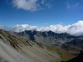 West side (summit is on the centre-right) | |
| Highest point | |
| Elevation | 2,810 m (9,220 ft) |
| Prominence | 237 m (778 ft) [1] |
| Isolation | 2.5 kilometres (1.6 mi) |
| Parent peak | Aroser Rothorn |
| Coordinates | 46°43′32″N 9°39′37″E / 46.72556°N 9.66028°ECoordinates: 46°43′32″N 9°39′37″E / 46.72556°N 9.66028°E |
| Geography | |
 Guggernellgrat Location in Switzerland | |
| Location | Graubünden, Switzerland |
| Parent range | Plessur Alps |
The Guggernellgrat is a mountain of the Plessur Alps, located south of Arosa in the canton of Graubünden.
References
External links

- Guggernellgrat on Hikr
This article is issued from
Wikipedia.
The text is licensed under Creative Commons - Attribution - Sharealike.
Additional terms may apply for the media files.