Gudu
| Gud | |
|---|---|
| LGA | |
 Gud Location in Nigeria | |
| Coordinates: 13°28′N 4°26′E / 13.467°N 4.433°ECoordinates: 13°28′N 4°26′E / 13.467°N 4.433°E | |
| Country |
|
| State | Sokoto State |
| Area | |
| • Total | 3,478 km2 (1,343 sq mi) |
| Population (2006 census) | |
| • Total | 95,544 |
| Time zone | UTC+1 (WAT) |
| 3-digit postal code prefix | 841 |
| ISO 3166 code | NG.SO.GU |
Gudu is a Local Government Area in Sokoto State, Nigeria. Its headquarters are in the town of Balle.
With an area of 3,478 km² and a population of 95,544 at the 2006 census, Gudu shares a boundary with the Republic of Niger to the north and the west. In 1804 Gudu was the capital of the Sokoto Caliphate.
The postal code of the area is 841.[1]
References
- ↑ "Post Offices- with map of LGA". NIPOST. Archived from the original on 2009-10-07. Retrieved 2009-10-20.
State capital: Sokoto | ||
| Local Government Areas | 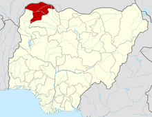 | |
This article is issued from
Wikipedia.
The text is licensed under Creative Commons - Attribution - Sharealike.
Additional terms may apply for the media files.