Gudivada mandal
| Gudivada mandal | |
|---|---|
| Mandal | |
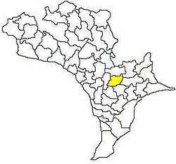 Mandal map of Krishna district showing Gudivada mandal (in yellow) | |
 Gudivada mandal Location in Andhra Pradesh, India | |
| Coordinates: 16°26′N 80°59′E / 16.43°N 80.99°ECoordinates: 16°26′N 80°59′E / 16.43°N 80.99°E | |
| Country | India |
| State | Andhra Pradesh |
| District | Krishna |
| Headquarters | Gudivada |
| Population (2011)[1] | |
| • Total | 161,453 |
| Languages | |
| • Official | Telugu |
| Time zone | UTC+5:30 (IST) |
Gudivada mandal is one of the 50 mandals in Krishna district of the state of Andhra Pradesh in India. It is under the administration of Gudivada revenue division and the headquarters are located at Gudivada town.[2][3] The mandal is bounded by Pedaparupudi, Nandivada, Mandavalli, Mudinepalle, Gudlavalleru, Pamarru mandals of Krishna district.[4]
Demographics
As of 2011 census, the mandal had a population of 161,453. The total population constitute, 80,752 males and 80,701 females —a sex ratio of 999 females per 1000 males. 14,932 children are in the age group of 0–6 years, of which 7,651 are boys and 7,281 are girls. The average literacy rate stands at 79.55% with 116,556 literates.[1]
Administration
The mandal is partially a part of the Andhra Pradesh Capital Region under the jurisdiction of APCRDA.[5]
Towns and villages
As of 2011 census, the mandal has 30 settlements. It includes 1 town and 29 villages.[2] The settlements in the mandal are listed below:
- Allidoddi
- Bethavolu (rural)
- Billapadu (rural)
- Bommuluru
- Chilakamudi
- China Yerukapadu
chirichintala
hintal# Chowtapalle
- Dondapadu
- Gangadharapuram
- Gudivada (M)†
- Gudivada (rural)
- Guntakoduru
- Kalvapudi Agraharam
- Kasipudi
- Lingavaram
- Mandapadu (rural)
- Merakagudem
- Moturu
- Pedyerukapadu (rural)
- Ramachandrapuram
- Ramanapudi
- Saidepudi
- Seepudi
- Seri Dintakurru
- Seri Golvepalle
- Seri Velpur
- Siddhantam
- Tativarru
- Valivarthipadu (rural)
Note: †–Mandal Headquarters, M-Municipality[6]
See also
References
- 1 2 "Census 2011". The Registrar General & Census Commissioner, India. Retrieved 12 September 2014.
- 1 2 "Krishna District Mandals" (PDF). Census of India. pp. 504, 528–529. Retrieved 17 July 2015.
- ↑ "Administrative Setup". Krishna District Official Website. National Informatics Centre. Retrieved 17 July 2015.
- ↑ "Mandals in Krishna district". aponline.gov.in. Archived from the original on 13 December 2014. Retrieved 17 July 2015.
- ↑ "Declaration of A.P. CapitalRegion" (PDF). APCRDA. Municipal Administration and Urban Development Department. 23 June 2016. Archived from the original (PDF) on 23 September 2015. Retrieved 21 February 2016.
- ↑ "Some Concepts and Definitions" (PDF). Census of India 2011. Retrieved 17 July 2015.
External links
| Wikimedia Commons has media related to Gudivada. |