Grudynia Mała
| Grudynia Mała | |
|---|---|
| Village | |
 Shop of the local business enterprise | |
 Grudynia Mała | |
| Coordinates: 50°14′N 17°57′E / 50.233°N 17.950°E | |
| Country |
|
| Voivodeship | Opole |
| County | Kędzierzyn-Koźle |
| Gmina | Pawłowiczki |
Grudynia Mała [ɡruˈdɨɲa ˈmawa] (German: Klein Grauden) is a village in the administrative district of Gmina Pawłowiczki, within Kędzierzyn-Koźle County, Opole Voivodeship, in south-western Poland.[1] It lies approximately 8 kilometres (5 mi) west of Pawłowiczki, 22 km (14 mi) south-west of Kędzierzyn-Koźle, and 49 km (30 mi) south of the regional capital Opole.
Before 1945 the area was part of Germany (see Territorial changes of Poland after World War II).
Gallery
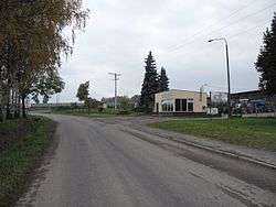
 Village square
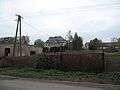 Garden
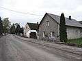 Street
References
| Wikimedia Commons has media related to Grudynia Mała. |
Coordinates: 50°14′N 17°57′E / 50.233°N 17.950°E
This article is issued from
Wikipedia.
The text is licensed under Creative Commons - Attribution - Sharealike.
Additional terms may apply for the media files.