Gross Lohner
| Gross Lohner | |
|---|---|
| Vorder Lohner | |
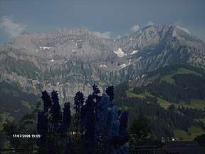 Gross Lohner as seen from the north (from left to right): Nünihorn, Hinter Lohner, Mittler Lohner, Vorder Lohner, Mittaghorn | |
| Highest point | |
| Elevation | 3,049 m (10,003 ft) |
| Prominence | 564 m (1,850 ft) [1] |
| Isolation | 5 kilometres (3.1 mi) |
| Parent peak | Wildstrubel |
| Coordinates | 46°27′45″N 7°36′0″E / 46.46250°N 7.60000°ECoordinates: 46°27′45″N 7°36′0″E / 46.46250°N 7.60000°E |
| Geography | |
 Gross Lohner Location in Switzerland | |
| Location | Bern, Switzerland |
| Parent range | Bernese Alps |
| Climbing | |
| First ascent | 1875, by Kandersteg guides Ogi and Hari[2] |
The Gross Lohner (also spelled Gross Loner, German: Great Lohner), is a limestone mountain of the Bernese Alps, located between Adelboden and Kandersteg in the Bernese Oberland. The main summit has an elevation of 3,048.7 metres (10,002 ft) above sea level and is distinguished by the name Vorder Lohner ("Fore Lohner"). The mountain features several other peaks, from east to west:[3]
- Nünihorn, 2,717 metres (8,914 ft)
- Hinder Lohner (Rear Lohner), 2,929 metres (9,610 ft)
- Mittler Lohner (Central Lohner), 3,002 metres (9,849 ft)
- Mittaghorn, 2,678 metres (8,786 ft)
The Lohner range is located east of Adelboden in the Engstlige valley and southwest of Kandersteg in Kander valley. The Gross Lohner is separated from the Chlyne Lohner (Small Lohner) to the north by the Bunderchrinde Pass, which provides a hiking route between Adelboden and Kandersteg.[3][4]
The first tourist to climb the Lohner was one C. Dürheim from Bern in July 1876. In August of the same year, four members of the Alpine Club, during another ascent, found a bottle with the names of the two Kandersteg mountain guides Ogi and Hari, dated 1875.[2]
Approximately halfways up the rock face, the Lohner hut can be found, which can be reached by skilled hikers without proper climbing.
The mountain with its many screes is almost only accessible by one of its three ridges. From the Lohner hut, the Mittler Lohner can be reached via the face by skilled climbers.
References
- ↑ Retrieved from the Swisstopo topographic maps and Google Earth. The key col lies on the Schedelsgrätli at 2,485 metres.
- 1 2 Stettler, Karl. Das Frutigbuch, 1887, p. 466 (in German)
- 1 2 map.geo.admin.ch (Map). Swiss Confederation. Retrieved 2015-05-21.
- ↑ Reynolds, Kev (2011). "Trek 10 - Alpine Pass Route". Trekking in the Alps. Cicerone. pp. 124–135. ISBN 978 1 85284 600 8.
External links

- Gross Lohner on SummitPost
- Gross Lohner on Hikr