Müggelberge
| Müggelberge | |
|---|---|
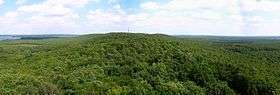 View from the Müggel Tower looking east along the Müggelberge | |
| Highest point | |
| Peak | Großer Müggelberg |
| Elevation | 114.7 m above NHN |
| Geography | |
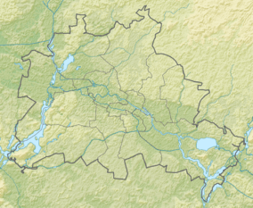 | |
| State |
Berlin, |
| Range coordinates | 52°24′58″N 13°38′00″E / 52.41611°N 13.63333°ECoordinates: 52°24′58″N 13°38′00″E / 52.41611°N 13.63333°E |
| Geology | |
| Orogeny | Terminal moraine |
| Age of rock | Weichselian glaciation (about 20,000 years ago) |
| Type of rock | Glacial meltwater sand, occasional till |
The Müggelberge (also formerly called the Müggelsberge) are a wooded line of hills with heights up to 114.7 m above sea level (NHN)[1] in the southeast of Berlin's Treptow-Köpenick quarter. They are dominated by the Kleiner Müggelberg (88.3 m) and Großer Müggelberg (114.7 m). The Müggelberge cover an area of around seven square kilometres. The ridge was formed during the ice age.

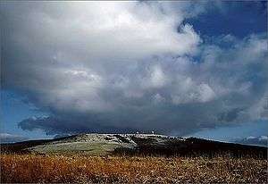
View from Friedrichshagen
A viewing tower called the Müggelturm has been erected on the hills with a view of the Müggelsee and the Berlin-Müggelberge TV Tower.
See also
References
- ↑ Catrin Gottschalk, Vermessungsamt Treptow-Köpenick: "Johann Jacob Baeyer oder Wie hoch sind die Müggelberge wirklich?". Archived from the original on February 8, 2011. Retrieved 2007-01-15. In: Bezirksamt Treptow-Köpenick von Berlin (publ.): Rathaus Journal Treptow-Köpenick, 11/2006, p. 5.
External links
![]()
|  | |
This article is issued from
Wikipedia.
The text is licensed under Creative Commons - Attribution - Sharealike.
Additional terms may apply for the media files.