Greenfield, Oklahoma
| Greenfield, Oklahoma | |
|---|---|
| Town | |
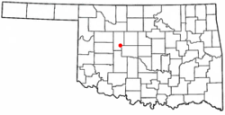 Location of Greenfield, Oklahoma | |
| Coordinates: 35°43′43″N 98°22′39″W / 35.72861°N 98.37750°WCoordinates: 35°43′43″N 98°22′39″W / 35.72861°N 98.37750°W | |
| Country | United States |
| State | Oklahoma |
| County | Blaine |
| Area | |
| • Total | 0.1 sq mi (0.3 km2) |
| • Land | 0.1 sq mi (0.3 km2) |
| • Water | 0.0 sq mi (0.0 km2) |
| Elevation | 1,457 ft (444 m) |
| Population (2010) | |
| • Total | 93 |
| • Density | 702/sq mi (271.1/km2) |
| Time zone | UTC-6 (Central (CST)) |
| • Summer (DST) | UTC-5 (CDT) |
| ZIP code | 73043 |
| Area code(s) | 580 |
| FIPS code | 40-31250[1] |
| GNIS feature ID | 1093384[2] |
Greenfield is a town in Blaine County, Oklahoma, United States. The population was 93 at the 2010 census.[3]
Geography
Greenfield is located in southern Blaine County at 35°43′43″N 98°22′39″W / 35.728746°N 98.377448°W.[4] It is along U.S. Routes 281 and 270, halfway between Watonga, the county seat, and Geary.
According to the United States Census Bureau, the town has a total area of 0.1 square miles (0.26 km2), all of it land.
Demographics
| Historical population | |||
|---|---|---|---|
| Census | Pop. | %± | |
| 1940 | 303 | — | |
| 1950 | 191 | −37.0% | |
| 1960 | 128 | −33.0% | |
| 1970 | 143 | 11.7% | |
| 1980 | 233 | 62.9% | |
| 1990 | 200 | −14.2% | |
| 2000 | 123 | −38.5% | |
| 2010 | 93 | −24.4% | |
| Est. 2015 | 93 | [5] | 0.0% |
| U.S. Decennial Census[6] | |||
As of the census[1] of 2000, there were 123 people, 55 households, and 37 families residing in the town. The population density was 919.7 people per square mile (365.3/km2). There were 62 housing units at an average density of 463.6 per square mile (184.1/km2). The racial makeup of the town was 88.62% White, 1.63% African American and 9.76% Native American.
There were 55 households out of which 23.6% had children under the age of 18 living with them, 47.3% were married couples living together, 14.5% had a female householder with no husband present, and 32.7% were non-families. 32.7% of all households were made up of individuals and 14.5% had someone living alone who was 65 years of age or older. The average household size was 2.24 and the average family size was 2.78.
In the town, the population was spread out with 19.5% under the age of 18, 8.9% from 18 to 24, 22.8% from 25 to 44, 35.0% from 45 to 64, and 13.8% who were 65 years of age or older. The median age was 44 years. For every 100 females, there were 98.4 males. For every 100 females age 18 and over, there were 98.0 males.
The median income for a household in the town was $20,694, and the median income for a family was $21,607. Males had a median income of $26,250 versus $20,000 for females. The per capita income for the town was $13,097. There were 20.0% of families and 17.6% of the population living below the poverty line, including 37.5% of under eighteens and 11.1% of those over 64.
References
- 1 2 "American FactFinder". United States Census Bureau. Archived from the original on 2013-09-11. Retrieved 2008-01-31.
- ↑ "US Board on Geographic Names". United States Geological Survey. 2007-10-25. Retrieved 2008-01-31.
- ↑ "Geographic Identifiers: 2010 Demographic Profile Data (G001): Greenfield town, Oklahoma". U.S. Census Bureau, American Factfinder. Retrieved February 24, 2014.
- ↑ "US Gazetteer files: 2010, 2000, and 1990". United States Census Bureau. 2011-02-12. Retrieved 2011-04-23.
- ↑ "Annual Estimates of the Resident Population for Incorporated Places: April 1, 2010 to July 1, 2015". Archived from the original on June 2, 2016. Retrieved July 2, 2016.
- ↑ "Census of Population and Housing". Census.gov. Archived from the original on May 12, 2015. Retrieved June 4, 2015.
External links
Municipalities and communities of Blaine County, Oklahoma, United States | ||
|---|---|---|
| Cities | 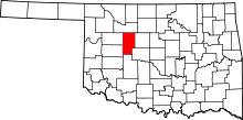 | |
| Towns | ||
| Unincorporated communities | ||
| Footnotes | ‡This populated place also has portions in an adjacent county or counties | |