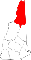
Green's Grant, New Hampshire
Coordinates: 44°18′02″N 71°13′19″W / 44.30056°N 71.22194°W
_end_of_the_Mount_Washington_Auto_Road_in_Green's_Grant_Township%2C_Coos_County%2C_New_Hampshire.jpg)
Green's Grant is a township located in Coos County, New Hampshire, United States. As of the 2010 census, the grant had a total population of 1.[1] In New Hampshire, locations, grants, townships (which are different from towns), and purchases are unincorporated portions of a county which are not part of any town and have limited self-government (if any, as many are uninhabited).
Geography
According to the United States Census Bureau, the grant has a total area of 3.7 square miles (9.6 km2), none of which is covered by water bodies other than streams. The highest point in the grant is along its eastern boundary, on the lower slopes of Middle Carter Mountain, where the elevation reaches 2,540 feet (770 m) above sea level.
Demographics
| Historical population | |||
|---|---|---|---|
| Census | Pop. | %± | |
| 1860 | 14 | — | |
| 1870 | 71 | 407.1% | |
| 1880 | 8 | −88.7% | |
| 1890 | 30 | 275.0% | |
| 1900 | 13 | −56.7% | |
| 1910 | 4 | −69.2% | |
| 1920 | 5 | 25.0% | |
| 1930 | 4 | −20.0% | |
| 1940 | 3 | −25.0% | |
| 1960 | 2 | — | |
| 2010 | 1 | — | |
| Est. 2015 | 1 | [2] | 0.0% |
| U.S. Decennial Census[3] | |||
As of the census[4] of 2010, there was 1 person living in the grant.
Attractions
The base of the Mount Washington Auto Road is located in Green's Grant.
References
- ↑ United States Census Bureau, American FactFinder, 2010 Census figures. Retrieved March 23, 2011.
- ↑ "Annual Estimates of the Resident Population for Incorporated Places: April 1, 2010 to July 1, 2015". Archived from the original on June 2, 2016. Retrieved July 2, 2016.
- ↑ "Census of Population and Housing". Census.gov. Archived from the original on May 12, 2015. Retrieved June 4, 2016.
- ↑ "American FactFinder". United States Census Bureau. Archived from the original on 2013-09-11. Retrieved 2008-01-31.
Places adjacent to Green's Grant, New Hampshire | |
|---|---|