Ontong Java Plateau
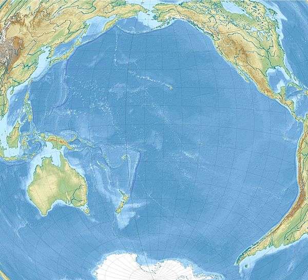
The Ontong Java Plateau (OJP) is a huge oceanic plateau located in the south-west Pacific Ocean, north of the Solomon Islands. The OJP was emplaced c. 120 Ma with a much smaller volcanic event c. 90 Ma. Two other south-west Pacific plateaus, Manihiki and Hikurangi, now separated from the OJP by Cretaceous ocean basins, are of similar age and composition and probably formed as a single plateau and a contiguous large igneous province together with the OJP.[1] When emplaced this Ontong Java-Manihiki-Hikurangi plateau covered 1% of Earth's surface and represented a volume of 80,000,000 km3 (19,000,000 cu mi) of basaltic magma.[2] This "Onotong Java event", first proposed in 1991, represents the largest volcanic event of the past 200 million years, with a magma emplacement rate estimated at up to 22 km3 (5.3 cu mi)/year over three million years, several times larger than the Deccan Traps.[3] The smooth surface of the OJP is punctuated by seamounts such as the Ontong Java Atoll, the largest atoll in the world.[4]
Geological setting
The OJP covers 1,500,000 km2 (580,000 sq mi), roughly the size of Alaska. It reaches up to 1,700 m (5,600 ft) below sea level but has an average depth closer to 2–3 km (1.2–1.9 mi). It is bounded by Lyra Basin to the north-west, East Mariana Basin to the north, Nauru Basin to the north-east, and the Ellice Basin to the south-east. The OJP has collided with the Solomon Islands island arc and now lies on the inactive Vitiaz Trench and the Pacific-Australian plate boundary.[4]
The high plateau, with a crustal thickness estimated to at least 25 km (16 mi) but probably closer to 36 km (22 mi), has a volume of more than 5,000,000 km3 (1,200,000 cu mi). The maximum extent of the event can, however, be much larger since lavas in several surrounding basins are closely related to the OJP event and probably represent dike swarms associated with the emplacement of the OJP.[4]
Tectonic evolution
OJP formed quickly over a mantle plume head, most likely the then newly formed Louisville hotspot, followed by limited volcanism for at least 30 million years. The extant seamounts of the Louisville Ridge started to form 70 Ma and have a different isotopic composition, and therefore a shift in intensity and magma supply in the plume must have occurred before that.[5]
The early, short-duration eruptions of OJP coincide with the global Early Aptian oceanic anoxic event (known as OAE1a or the Selli Event, 125.0–124.6 Ma) that lead to the deposition of black shales during the interval 124–122 Ma. Additionally, isotopic records of seawater in sediments have been associated with the 90 Ma OJP submarine eruptions.[6]
About 80% of the OJP is being subducted beneath the Solomon Islands. Only the uppermost 7 km of the crust is preserved on the Australian Plate.[7] This collision has lifted some of the OJP between 200–2,000 m (660–6,560 ft) above sea level. The construction of Pliocene stratovolcanoes in the western end of the convergence zone has resulted in the New Georgia Islands (1,768 m (5,801 ft)) and Bougainville Island (2,743 m (8,999 ft)). Shortening, uplift, and erosion of the northern Melanesian arc and the Malaita accretionary prism at deep levels has produced Guadacanal (2,447 m (8,028 ft)), Makira (1,250 m (4,100 ft)), and Malaita (1,251 m (4,104 ft)).[8]
References
Notes
- ↑ Taylor 2006, Abstract
- ↑ Rizo 2016
- ↑ Tarduno et al. 1991, p. 401
- 1 2 3 Neal et al. 1993, Physical features and gross structure of the OJP, pp. 184–187
- ↑ Mahoney et al. 1993, Abstract
- ↑ Tejada et al. 2009, Abstract; Introduction, pp. 855–856
- ↑ Mann & Taira 2004, Abstract
- ↑ Mann & Taira 2004, Erosional levels of rocks in the Solomon Islands, p. 166
Sources
- Mahoney, J. J.; Storey, M.; Duncan, R. A.; Spencer, K. J.; Pringle, M. (1993). "Geochemistry and age of the Ontong Java Plateau" (PDF). The Mesozoic Pacific: geology, tectonics, and volcanism. Geophys. Monogr. Ser. 77. Washington, D. C.: AGU. pp. 233–261. Bibcode:1993GMS....77..233M. doi:10.1029/GM077p0233. Retrieved 17 December 2016.
- Mann, P.; Taira, A. (2004). "Global tectonic significance of the Solomon Islands and Ontong Java Plateau convergent zone" (PDF). Tectonophysics. 389 (3): 137–190. Bibcode:2004Tectp.389..137M. doi:10.1016/j.tecto.2003.10.024. Retrieved 18 December 2016.
- Neal, C. R.; Mahoney, J. J.; Kroenke, L. W.; Duncan, R. A.; Petterson, M. G. (1997). "The Ontong Java Plateau" (PDF). In Mahoney, J. J.; Coffin, F. Large Igneous Provinces: Continental, Oceanic, and Planetary Flood Volcanism. Geophys. Monogr. Ser. 100. Washington D.C.: AGU. pp. 183–216. Bibcode:1997GMS...100..183N. doi:10.1029/GM100p0183. Archived from the original (PDF) on 1 January 2017. Retrieved 17 December 2016.
- Rizo, H. (September 2016). "September 2016 LIP of the Month: Phanerozoic Large Igneous Provinces sample remnants of early differentiation events on Earth". Large Igneous Provinces Commission. Retrieved 14 April 2017.
- Tarduno, J. A.; Mayer, H.; Winterer, E. L.; Sliter, W. V.; Kroenke, L.; Mahoney, J. J.; Leckie, M.; Musgrave, R.; Storey, M. (1991). "Rapid formation of Ontong Java Plateau by Aptian mantle plume volcanism" (PDF). Science. 254 (5030): 399–403. Bibcode:1991Sci...254..399T. doi:10.1126/science.254.5030.399. Retrieved 17 December 2016.
- Taylor, Brian (31 January 2006). "The single largest oceanic plateau: Ontong Java-Manihiki-Hikurangi" (PDF). Earth and Planetary Science Letters. 241 (3–4): 372–380. Bibcode:2006E&PSL.241..372T. doi:10.1016/j.epsl.2005.11.049. Retrieved 17 December 2016. Lay summary (6 February 2006).
- Tejada, M. L. G.; Suzuki, K.; Kuroda, J.; Coccioni, R.; Mahoney, J. J.; Ohkouchi, N.; Sakamoto, T.; Tatsumi, Y. (2009). "Ontong Java Plateau eruption as a trigger for the early Aptian oceanic anoxic event" (PDF). Geology. 37 (9): 855–858. Bibcode:2009Geo....37..855T. doi:10.1130/G25763A.1. Retrieved 17 December 2016.
Further reading
- Fitton, J. G.; Mahoney, J. J.; Wallace, P. J.; Saunders, A. D. (2004). "Origin & Evolution of the Ontong Java Plateau: introduction" (PDF). Geological Society, London, Special Publications. 229. Bibcode:2004GSLSP.229....1F. doi:10.1144/GSL.SP.2004.229.01.01. ISBN 978-1-86239-157-4. Retrieved 17 December 2016. (Ocean Drilling Program: Volume 192 Scientific Results)