Great Andaman
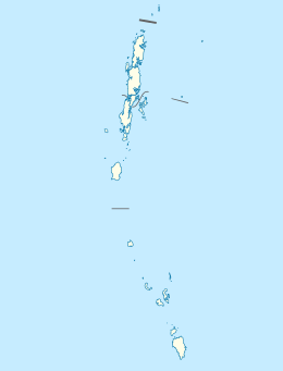
 Great Andaman Location of Great Andaman | |
| Geography | |
|---|---|
| Location | Bay of Bengal |
| Coordinates | 11°23′42″N 92°33′18″E / 11.395°N 92.555°ECoordinates: 11°23′42″N 92°33′18″E / 11.395°N 92.555°E |
| Archipelago | Andaman Islands |
| Adjacent bodies of water | Indian Ocean |
| Total islands | 200 |
| Major islands |
|
| Area | 4,823.5 km2 (1,862.4 sq mi)[1] |
| Highest elevation | 0 m (0 ft)[2] |
| Administration | |
| District | South Andaman |
| Island group | Andaman Islands |
| Largest settlement | Port Blair |
| Demographics | |
| Population | 315540 (2011) |
| Pop. density | 65.4 /km2 (169.4 /sq mi) |
| Ethnic groups | Hindu, Andamanese |
| Additional information | |
| Time zone | |
| PIN | 744202[3] |
| Telephone code | 031927 [4] |
| ISO code | IN-AN-00[5] |
| Official website |
www |
| Literacy | 84.4% |
| Avg. summer temperature | 30.2 °C (86.4 °F) |
| Avg. winter temperature | 23.0 °C (73.4 °F) |
| Sex ratio | 1.2♂/♀ |
| Census Code | 35.639.0004 |
| Official Languages | Hindi, English |
Great Andaman is the main archipelago of the Andaman Islands of India. It comprises seven major islands. From north to south, these are North Andaman, Interview Island, Middle Andaman, Long Island, Baratang Island, South Andaman, and Rutland Island.
Geography
South, Middle and North islands are the largest of the entire island group. The islands' capital, Port Blair, is located on South Andaman.
Great Andaman group is often considered the counterpart to Little Andaman Group, another group of islands in the Andaman's.
The Andaman islands consist of five groups:
- Great Andaman
- Little Andaman
- Ritchie's Archipelago
- East Volcano Islands
Narrow creeks split Great Andaman into North Andaman, Middle Andaman, South Andaman and the other major islands. All of these islands are in the form of peaks of a submerged mountain chain. Each island has a central highland surrounded by bordering flat lands sloping in all directions and finally merged into coastal tracts.
Demographics
According to the 2011 census of India, the archipelago had 315,530 inhabitants.
References
- ↑ "Islandwise Area and Population - 2011 Census" (PDF). Government of Andaman.
- ↑ "Sailing Directions (enroute) | India and the Bay of Bengal" (PDF) (173). National Geospatial-intelligence Agency, United States Government. 2014. Retrieved 2016-09-23.
- ↑ "A&N Islands - Pincodes". 22 September 2016. Archived from the original on 23 March 2014. Retrieved 22 September 2016.
- ↑ "STD Codes of Andaman and Nicobar". allcodesindia.in. Retrieved 2016-09-23.
- ↑ Registration Plate Numbers added to ISO Code
